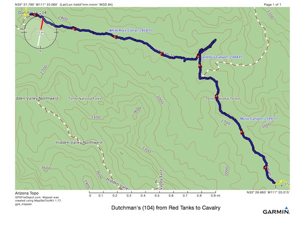
This part was 3.4 miles, 269’ ascent, 505’ descent, 3:54 (which included stopping for dinner) elapsed time.
Going by Charlebois Spring I did a little exploration. That’s where the little spur to the NE is on the track. I found water there, not in the spring, but above it, and decided to eat supper there, and then walk on some more before making camp for the night. I figured this would keep the food smells away from where I was going to sleep, and, let me walk off some of the supper calories before becoming still for the night.
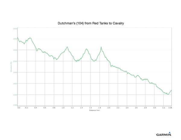
Overall a nice downward slope, except where I walked up to the spring several times.
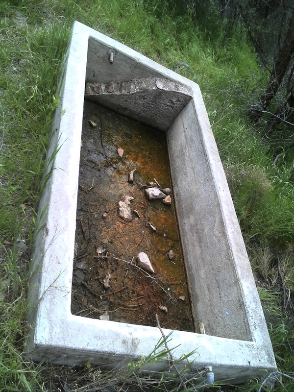
Charlebois Spring. Anyone thirsty?
A couple hundred yards above the official spring, I found a nice deep water filled hole, with frogs jumping in and out. I decided this would be good water, and decided to make dinner here. It was very buggy, and there was a lot of horse manure, but I made a dehydrated dinner and some tea and dug in. After which, I packed things back up and got to hiking again.
Halfway from Charlebois to Cavalry, I passed White Rock Canyon.