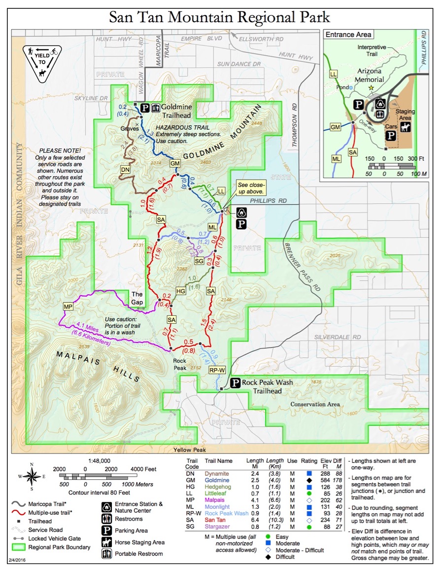
On Monday, February 21, after my personal training session, I decided to try to walk all the trails at San Tan Mountain. I have looked at these mountains for 30 years and wondered what they were like. Today I found out. The county provides the map shown below, and is an excellent resource. they also hand you a B&W copy when you pay your $6 entry fee at the kiosk.
I started out hiking with my light hikers. This turned out to be a mistake. One doesn’t really need hiking boots on these trails, as trail running shoes are usually adequate. I got going in the morning and decided to walk the southern portions, ending up with a loop shown below. I walked for 2.5 hours covering 7.3 miles. My right little toe was so sore after a couple of hours I decided to stop at the car for lunch and dress my wound. After doing this, I donned my trail running shoes for the afternoon.
I then hiked a loop on the northern section, finishing off the Moonlight and San Tan trails before starting the Dynamite heading north to the Goldmine trail head. My toe was really sore by now, and I realized I had the toughest trail, Goldmine, left to get back to the car. Nothing to do but hike on. I skipped toe Littleleaf trail altogether and decided to leave the loop at the south formed by the Malpais trail from the Rock Peak trail head. Rock Peak was an interesting feature as I hiked south in the morning.
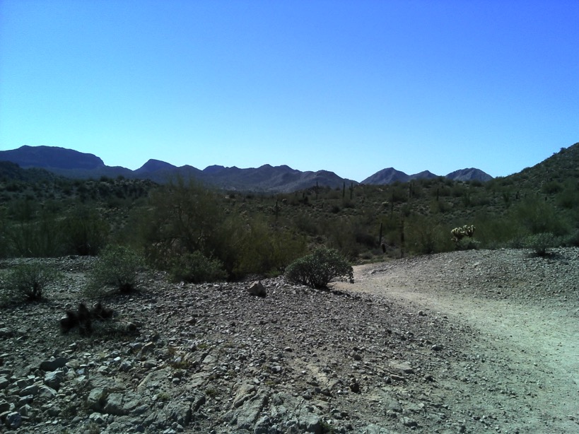
This is the general view in the area. These mountains are visible from all around Phoenix, and very close to Chandler, where I live. The terrain, flora and lack of shade, are omnipresent.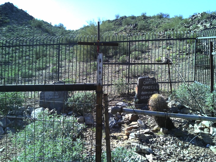
In the afternoon I paused here to read these monuments. These are real graves.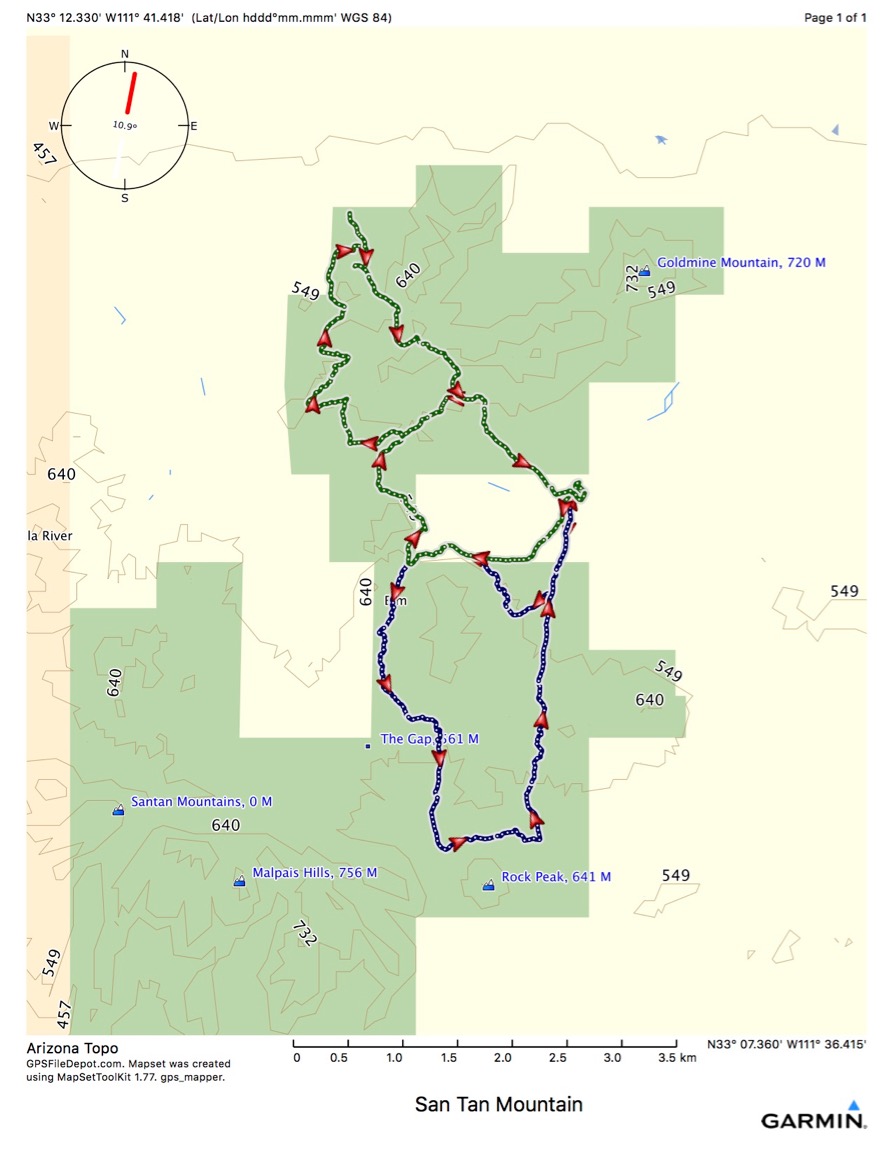
The blue is what I walked in the morning, and the green is after lunch.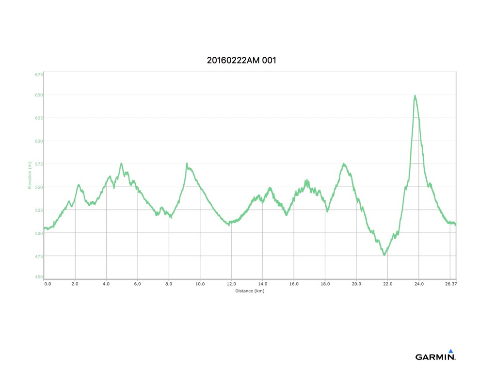
The only really challenging trail in terms of elevation change, was the final walk back on the Goldmine Trail. The rest of everything I walked is runnable.