Barnhardt Sandy Saddle Loop
What was supposed to be a 12 mile loop turned into 18 miles, with a 3 mile bushwhack in the middle. Partly a planning mistake I made, and partly the fact that the 3 mile Sandy Saddle “Trail” does not exist any more. There is nothing there but manzanita brush grown up 8’ high around and among all the growth that burned up in the Willow Fire in 2004. Each of those 3 miles took over an hour to path find, bust through the tangle, or scramble down the creek bed.
Things started out well enough. I began hiking at 6, just after sun up, on a nice, cool day. I thought I had a good plan, plenty of water, enough food, and even some just-in-case items, like a good strong headlamp. I wasn’t planning to spend a night or cook, so I had my pack weight down around 20 pounds, including 5 liters of water.
I knew the first 2.5 miles of the trail, as I had tried it last week. I knew it went nothing but up. I crossed the border into the Mazatzal Wilderness Area at about 0.9 miles up and hiked on. At about 1.3 miles, I looked up ahead and saw something black. At first I thought it was a dog, but it moved up the trail and I realized it was too big to be a dog. Then it stopped and looked back at me, and I saw it’s brown snout. It took a good look at me, from about 200 yards, then wheeled and began loping up the trail (away from me, ahead of me.) Or maybe it was cantering. Hey, it's really just a terminology difference between Western & Dressage. It's the same gait! Some folks will say that the lope is a slow canter in the way that the "jog" is a slow trot, BUT.
Anyway, I know bears don’t want anything to do with people. So I said to it, “You want some of this, huh?” and it kept running away, so I said “That’s what I thought!”
I knew the bear was running up the trail ahead of me, because it was the only thing possible. The side of the mountain on the left was too steep to climb without gear, and the side on the right was a steep drop off. My adrenaline was flowing because I could see less than 100 yards ahead at any time. Every time around a turn or a cactus or a cliff I wondered if I would see it again. But I didn’t. At about 2.6 miles, after climbing up all the switchbacks, I saw proof that the bear was still on the trail ahead of me:
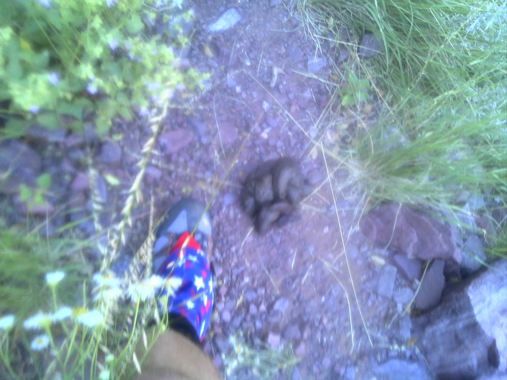
The scat next to my foot for size reference. 07:57 hours
This was very fresh, and strangely had no visible undigested material. If I had listened to Mike (ButtMunch) Douglass years ago and had a latex glove with me, I could have picked it up to take its temperature, but, alas, I did not. I hiked on, still on high alert. At 3.3 miles, I crossed the bottom of Big Kahuna Falls. Dry, of course.
Big Kahuna Falls. Dry. 08:29 hours
At about 3.6 miles, there was a very nice view off to the right (East).
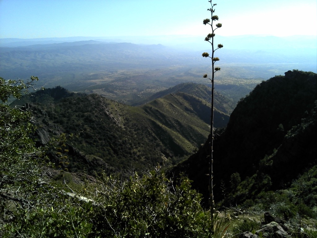
A very scenic vista. 08:41
At 4.2 miles, I decided to cache 2 liters of water and some food. I would be returning to the car at the end of the hike, and this would be the water and food needed for the last 2 hours of the hike. This lightened my load by about 5 pounds and was very welcome. I ate a little snack and began hiking the Barnhardt Trail again. I was planning to hike the loop counter-clockwise and turn right on the Sandy Saddle Trail as soon as I found the alleged intersection sign. I did see a faint path down to the right, but ignored it as there was no sign. After a while, I checked my GPS, and the intersection was behind me. Must be the sign burned up in the fire. This should have been a hint to me but I decided to hike on. I could hike the loop clockwise instead.
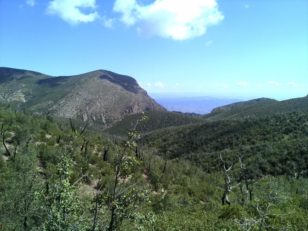
Another nice vista at about 5.6 miles -10:04
At the end of the Barnhardt Trail, I found the Mazatzal Divide Trail, which is also the Arizona Trail. This was about 6.4 miles, and it was about 1030.
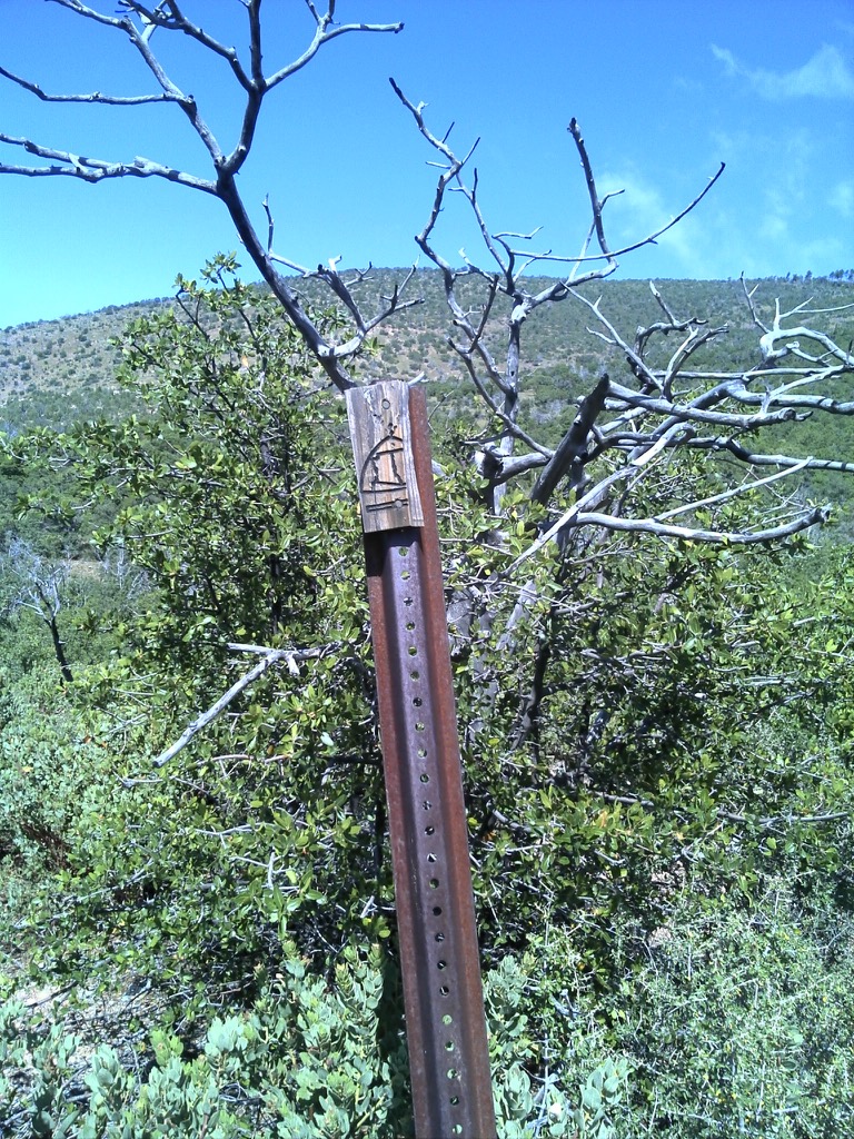
This may be an Az Trail marker. It’s the only trail marker of any kind I saw all day. 10:28 This sign was about a mile up the trail, 7.4 miles.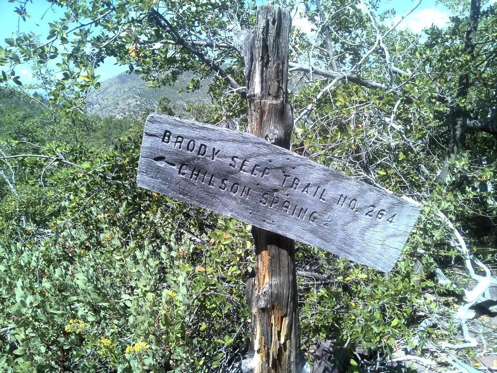
Brody Seep Trail 264 heads South off the Divide Trail 11:00
The Arizona Trail that I was now hiking on is a National Scenic Trail, like the first part of the Finger Lakes Trail, which is also part of the North Coast National Scenic Trail. Unlike the FLT, the Az Trail does not have blazes, at least not here. There is a faint footpath, and that’s it. Of course, it doesn’t require brushing out, or any other kind of maintenance. It’s in the desert. I didn’t go inspect the alleged Chilson Spring or the Brody Seep - I couldn’t see any water.
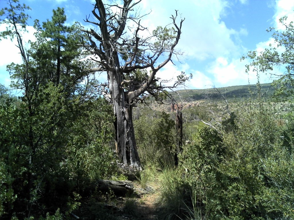
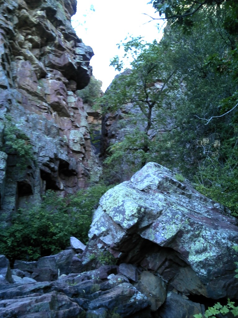
Off through the brush, a last glimpse of a very intriguing cliff along Deadman Creek. 12:00
At about 9.3 miles I made it to the intersection with the alleged Sandy Saddle Trail. At this point I was still under my self-induced delusion that this would be a 12 mile day. But I did start wondering how I could be here, having hiked 9 miles, and still have some miles to go before I got back to my cache, and then still have 4.2 miles back to the car. The math didn’t quite add up to 12. I kept thinking that I was way more than halfway done with my 12 mile plan. If I turned around and retraced my steps, it would be 18 miles. It was noon, and if I turned around, it would be 6 pm before I got back to the car. Unacceptable!
So I turned the way the GPS said to go for Sandy Saddle. It was in a creek bed. I re-read the trip report I had found, and it said that some route finding would be necessary here and to look for cairns. No cairns. But I followed the GPS track, checking my compass also, and things seemed right. Pretty soon I was in a manzanita thicket so close that I couldn’t move forward or backward. Every step was a concerted effort to put all my weight behind me and push through. But either the way to the right was a steep climb up a bank, which I tried many times, and kept sliding back down, or it was taking me farther from the GPS track. Many, many times, I stopped in frustration, and swore, and looked for the helicopter to take me back to the car. Then I did what I always do in the second part of an ultra. I remembered that all the math in the world didn’t matter. The only thing that mattered was to keep moving forward. In this case, safely. It was essential to not panic, or to not get in a big hurry and trip. Fall. Break a bone or hit my head. Have my bones found a few years later by a lost hunter. Just keep heading forward.
Some place in the 11th or 12th mile, I think, I was in a creek bed, getting very hot, and found a shady spot to sit in. I decided it was lunch time and I had a bite to eat, and some water to drink. I also took 2 salt stick caps and 2 Aleve tablets, since my right foot was really starting to hurt, and my muscles were cramping a little. I still had water, but I didn’t check my camelbak bladder to see how much water. It didn’t really matter, anyway. But shortly after that, I sucked the bladder dry and then I began to worry a bit more. I had brought enough water for 5 hours. I had already hiked 5 hours. 40% of my water was waiting for me at the cache up ahead, but, I was out, and I had no idea how long it would take to get to the cache. I was supposed to have been there hours ago. It was hot, I was out in the wild, without water, and getting very tired. I wasn’t lost - I knew exactly where I was, and I wasn’t worried about my GPS battery dying, as I had a full pack of charged up spare batteries. I was worried about my own charge - I didn’t plan to stay over night, and I sure didn’t have enough water to stay overnight.
As I stumbled along, I became more worried, but I also got to the end of every worry and realized that the only thing to do was to keep moving. So I did. And then, as I climbed down the very steep, dry, creek bed, I saw water on my left. Not much. Maybe a small seep about 6 feet long (above ground) and a foot deep. But it was moving, not stagnant, and I did have my filter. So I sat, and filtered, and drank, and filled my bladder. This was at about 12.3 miles. After drinking I felt much better and kept pressing on.
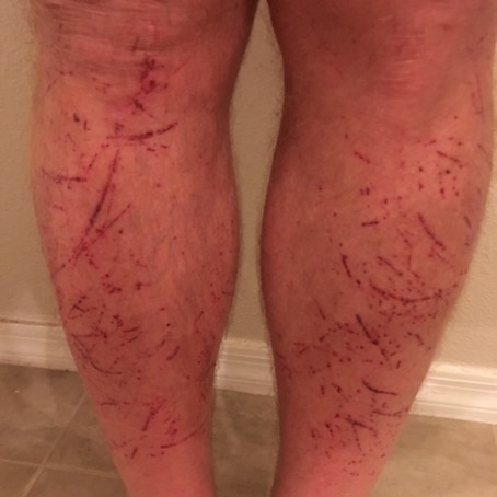
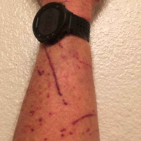
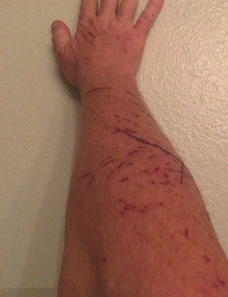
Back and forth between manzanita jungle and the steep creek bed descent. Some places I just got on my butt and slid down huge boulders without being able to see the landing spot, trusting there was no critter there. For a while I had collapsed my hiking poles and stowed them in my pack, being more trouble than they were worth. I was getting pretty tired, and tired of stumbling around, bulling my way through brush where there was supposed to be a trail. At about 12.9 miles, I pushed through a particularly thick spot and almost tumbled onto one of these:
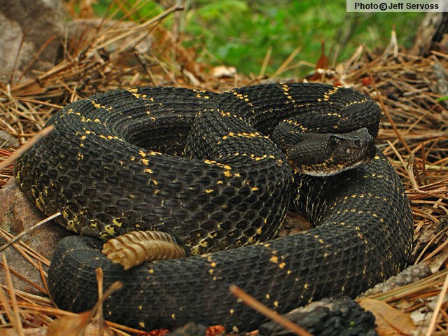
Although it was all coiled up, it did not look like it was ready to strike. Its head was not up, and I thought perhaps it was just keeping itself warm. I was not interested in an envenomation today, so I left it alone. Which is what everyone should do to all wildlife they encounter. You can read about the Arizona Black Rattlesnake here: http://www.reptilesofaz.org/Snakes-Subpages/h-c-cerberus.html. After stumbling through the thicket, I landed about 2 feet from it, but it did not move. In fact, at first I thought it was another pile of fresh scat. See what a little mental suggestion can do?
I started focusing on moving forward briskly but safely. It would not do to trip and fall (I didn’t fall all day). A broken bone or cracked head would be pretty troublesome. I had to maintain my focus, and keep moving steadily and carefully. Any step could result in a snake bite, a fall, and really bad trouble. I was already in really bad trouble and didn’t need any more.
I was in the 13th mile, and doing math again. 13+4 = 17, just what the web report I had read, and doubted, had said. Then I realized my planning mistake. I had neglected to add the 4.2 miles from the cache back to the car to the total mileage of the loop. That would have made it 16. And that only if I had followed the GPS track exactly. Which I probably hadn’t. Yikes .
At 13.9 miles, I finally saw my cache. It seemed like the last mile had taken hours. I kept looking at the navigation pointer to the cache on my GPS. If I just bushwhacked off to my left, it would be shorter. Several times I saw something white up on the ridge and thought for sure it was the white plastic grocery bag I had “secreted” my bladder and food in. I had been bushwhacking all afternoon, so I could just bushwhack straight to the white bag and save time. But, I decided to try to stay where the GPS said the trail was supposed to be. Finally, I was at the cache.
Now I knew I had 4.2 miles back to the car, but there was just one problem. It was already past 6:30 pm. I had already been hiking for over 12 hours, and there were less than 20 minutes until sunset. Fortunately, I had packed my new white, black and green light headlamp. I also had extra batteries for it just in case. I didn’t relish hiking down 2000’ over 4 miles, on switchbacks very close to a 400’ drop, in the dark, but, I had no choice.
I poured the 2 liters of fresh (warm) water into the bladder and started down. I was taking each step carefully. I wanted sooooooo badly to be done, but I knew I could not rush. A trip or stumble could be fatal. I fell into a (slow) rhythm of lifting my head to let the headlamp shine as far ahead as I could see, to make sure there were no large animals nearby (think bears) and then tipping my head down to watch each foot placement carefully. This was slow, slower than 30 minute mile pace, but necessary. The pace didn’t matter if I got back to the car safely. I was so tired. As they say these days, so ready to be done hiking. Nothing to do but to keep moving ahead carefully.
At night, you can see as far as your headlamp shines. Beyond the light, there could be more trail, or a sharp drop. This trail had several hairpin turns, and when I got to the switchbacks, nothing but sharp turns. I lost the trail a couple of times at these sharp turns, and had to backtrack carefully until I found it again. Slowly he turned, step by step, pace by pace, etc.
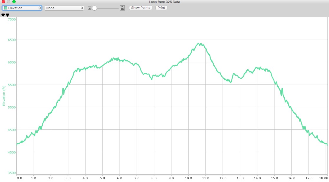
At 9:09 pm I finally reached my car. I changed my clothes and got in. I had been out for 14 hours and 38 minutes, of which 12:38 was moving. Meaning that I sat or stood still or fought with bushes or didn’t know what the heck to do for 2 hours. I had hiked 18.1 miles, ascended and descended 5,932 feet (over a mile). My heart rate average was 104 for the entire hike. The high point of the hike was 6,419’. A good, long day. More than an ultramarathon time wise, but not mileage wise. I am counting it as an ultra, nonetheless. After that, I ha only to drive the 2 hours home.
A couple days later I took these selfies of what the manzanita did to me:
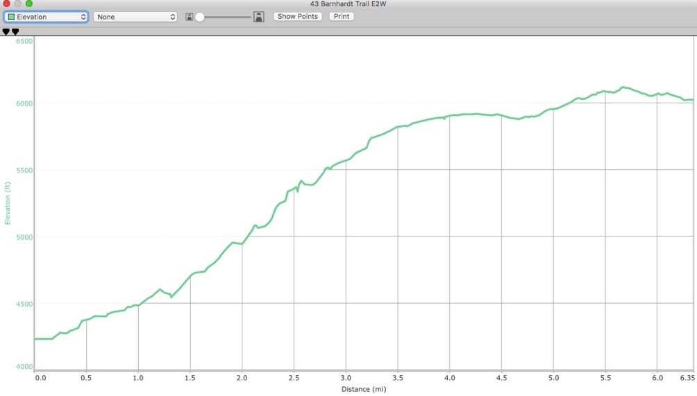
Here is the elevation profile for the hike:
Now, what did I learn? What do I think of this?
First, I spent quite a while wondering that when I got back safely, would I decide to stop solo backpacking? People have been telling me that it’s not safe for 20+ years. And yet, I have been doing it safely for 20+ years, and the people warning me off have never done it. Although I could be stubborn about this, I did begin to wonder. At my current age (23) it might be time to give in to the warnings. But of course, in all likelihood, no more solo backpacking means no more backpacking. I’m not sure I’m ready for that yet.
I could chastise myself (and did on the trail for about 6 hours) for not planning more carefully. I can admonish myself to plan more carefully next time. Can’t hurt to do so.
I can resolve to not go on such challenging events in the future. Of course, this was never intended to be very challenging. A couple of planning mistakes, and an obsolete map. And since I just bought the map from the US Forest Service, in that sense it is the current map.
I also can reflect on the total experience, and observe that while things very easily could have finished much more tragically (roll the drama) I did pretty damned good for an old guy given what he got himself into. Physically, although I was very tired, I “finished.” Mentally, I did all the right things. Serendipitously, I had good luck. Or perhaps, being well prepared and using my head, I was successful, luck aside. I’m not quite sure yet what to think. I do know without any doubt that this was my toughest hike ever. My self-confidence was challenged more than ever before. I was scared for a while. And yet, I didn’t lose it. I found out how I perform in another boundary condition. A la TS Eliot:

Perhaps I can go a little farther next time. Who knows?
The original plan is below.
Here’s a twist. Do the 12 mile loop in a day.
Start VERY early - be there at first light and start hiking. Start with a stomach full of water and have quarts in the car for after. So I can hike for a long time after starting, and before finishing, without needing to drink.
I won’t need to carry cooking or shelter equipment. Just ten essentials, lots of water, cold lunch, nuts, dried fruit, etc. I’ll throw in an emergency bivy and a headlamp just in case.
6 hours. 6 hurts, or 6 L, 13 pounds of water. I can cache 2 Liters where I branch off onto the Sandy Saddle trail, to have for the return on the Barnhardt Trail (4.1 miles).
The question is, do I take the 70L Jam Pack, or the Nathan. The Nathan holds a 2L bladder with room for some other stuff, but not room for 6L of water. The Jam holds a 3L bladder, so I could drink out of 1 3L until I branch off, then cache that one with 2L left in it, and use the full 3L bladder to get around the loop. Plenty of room for the extra stuff in the Jam, and I can cinch it down tight and compact. I think that’s the plan.
Now the weather forecast had been calling for a tropical storm. High below 90, and rain. But that is blowing away and looks like another shot day. Therefore, more important to get an early start. I have the GPS all loaded up...
Barnhardt #2
For my next performance, I will try to do better at the Bernhardt Trail.
First, some research. Here are the 3 most likely trails to hike, with their elevation graphs:
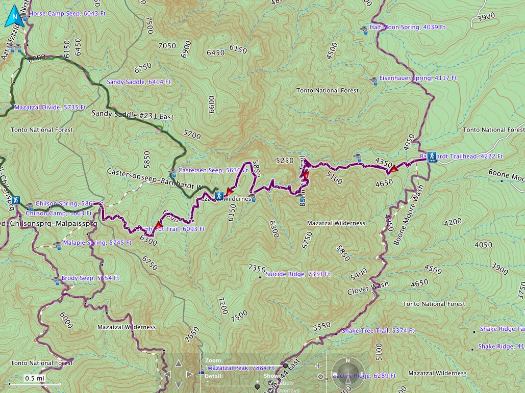
From the trailhead parking, elevation 4186’, this trail is 6.3 miles long, with 3600’ ascent and 1749’ descent. Hiking the entire trail would bring me to its juncture with the Mazatzal Divide Trail, at an elevation of about 6024’. Normally, this would take about 3 hours to hike, but with this much climb, and in the desert heat, it will probably take 4 hours to go all the way to the end.
Another option is to hike only 4.1 miles on this trail, and branch NW at the juncture with the Sandy Saddle Loop. These 4.1 miles would have 2867’ of ascent and 1129’ of descent, ending at an elevation of 5928’. Then I would begin hiking northwesterly on Sandy Saddle. It is 3.1 miles long with 1050’ ascent and 1033’ descent, ending at 5945’. I estimate hiking from the trail to this point would take 7.2 miles, 3917’ ascent and 2162’ descent. A little longer than the full Barnhardt Trail, I’d guess another hour, or 5 hours.
After driving 2 hours from home to the trailhead, these 5 hours would probably be enough for the day. I would start looking for a place to hang as I turn south on the Divide Trail.