Climbing over Camelback Mountain January 12, 2017
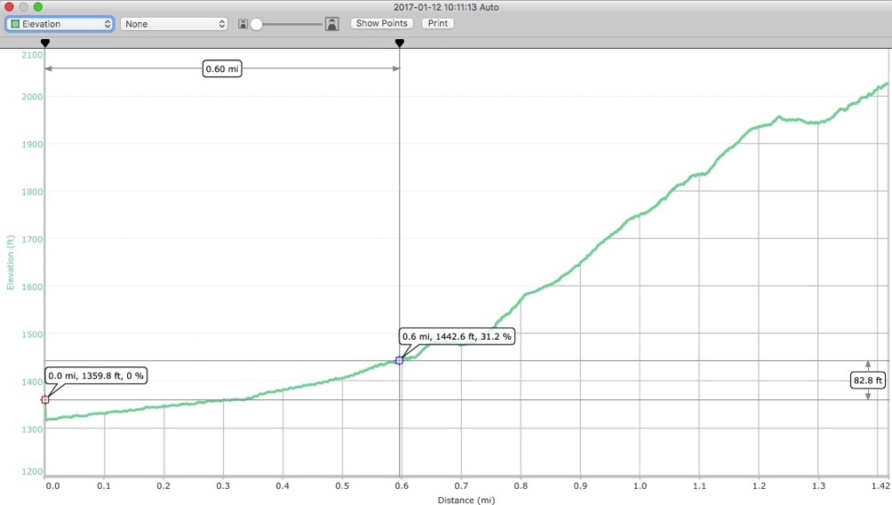
Jaeda and I got to the trailhead about 10, and found out there is no parking. No toilets. No water. No dogs. We had to park on the street around the corner, then hike up 0.6 miles to the actual trailhead.
Hiking up the Cholla Trail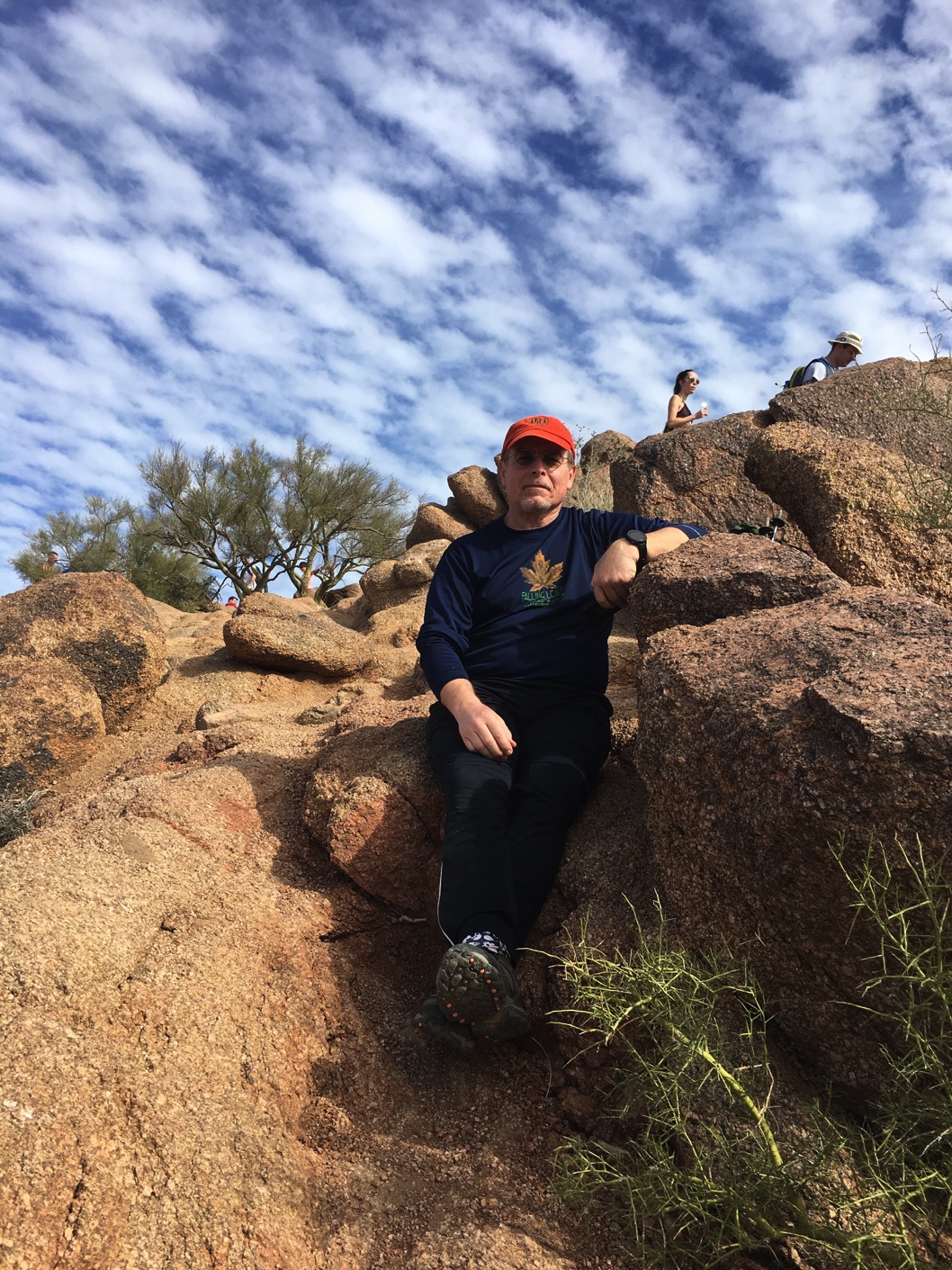
A little break at the top
Now at the top, we had a choice to make. We could slide back down the way we came, or, we could scramble down the shorter but allegedly steeper Echo Canyon Trail. Then we would have to Uber back to my car. I’d never changed plans like that before, being a stubborn old man. Sitting at the top, contemplating how I would ever get my 22 pound pack down the scrambles I had climbed up, I decided to try taking Echo Canyon down. And we did. It was much steeper, and I’m glad we did it. A couple of places required sliding down on my butt, but, overall I was very stable. My shoes didn’t slip, I kept my balance. Toward the bottom, at the steepest pitches of the camel’s head, hand rails had been installed, and I got a good upper body workout as well.
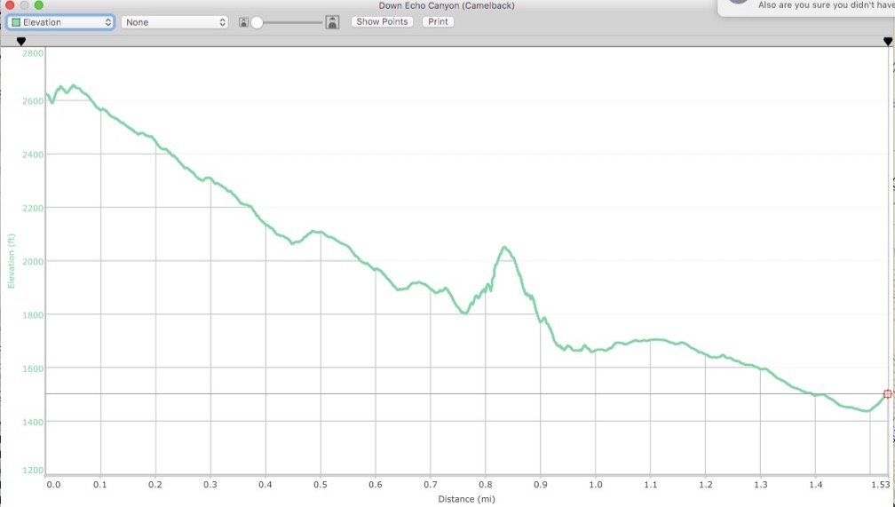
Coming down the Echo Canyon Trail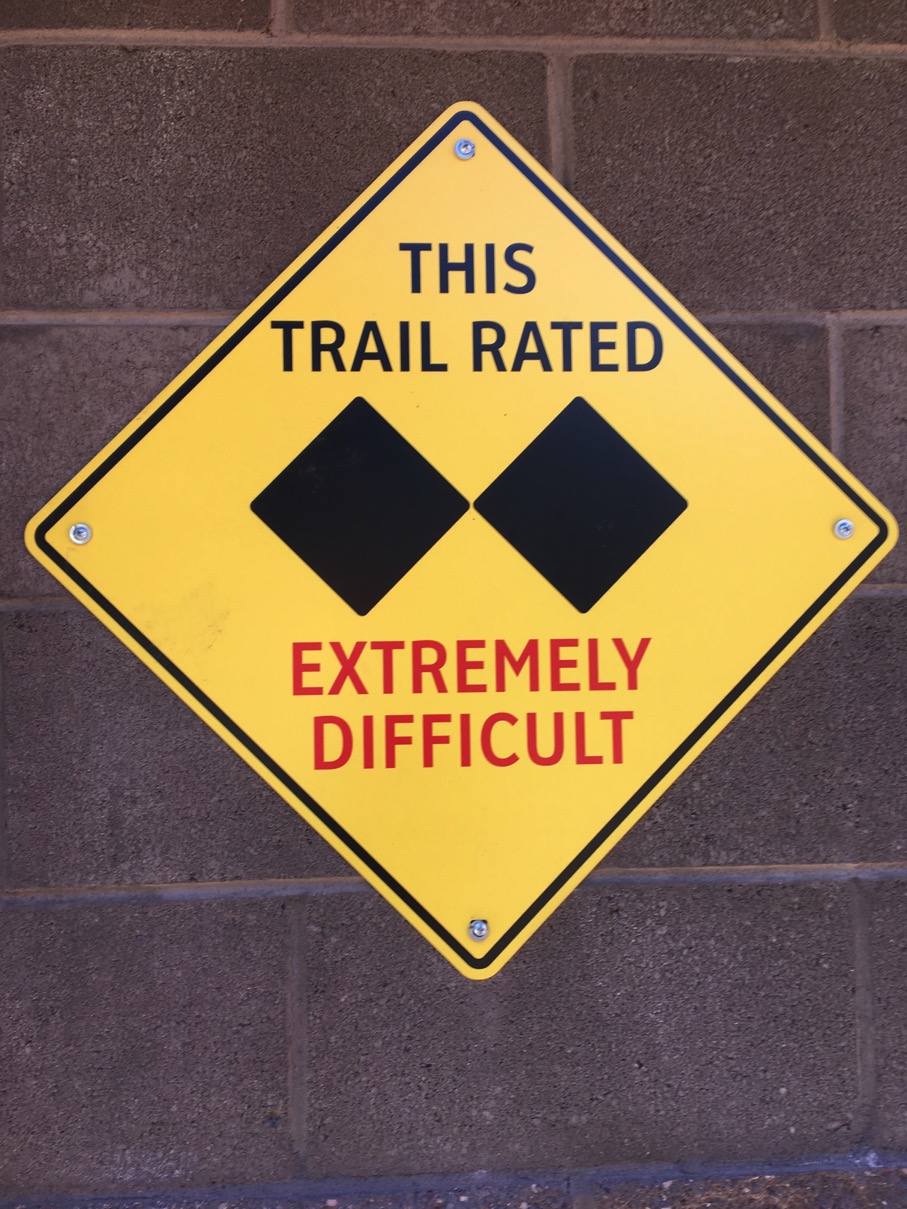
‘Nuff said
At the trailhead at the bottom, which does have an actual parking lot, bathrooms, water, I began chatting up a ranger. I asked her what was the easiest way back to the Cholla trailhead. There is a shuttle that runs every hour. But a guy sitting on the wall said that someone in the parking lot might give us a ride. Then Jaeda came up and he said he and his wife would take us back. And they did - lucky us!
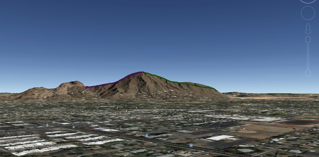
This is a screenshot from Google Earth. I plotted our track from my GPS and viewed it in Google Earth. The green line from the right up to the summit is the Cholla trail. The purple line coming down on the left is Echo Canyon. Then I tilted the view so I could orient our hike to the camel’s profile. I guess we started at the tail.