My First Double Header Hike
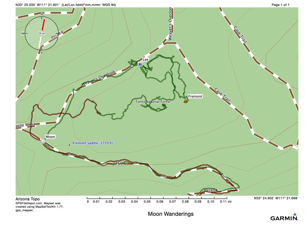
Today I completed my first double header. I hiked the Garden Valley loop with Stephen from Second Water trailhead in the Superstitions, drove home, took a brief nap, and then drove to Peralta trailhead and hiked up to Fremont Saddle for the full supermoon rise.
Things started early. Stephen had agreed to hike the 9.1 mile Black Mesa loop with me. Camille, studying for her Test of Essential Academic Skills exam for nursing school entrance, was unable to join us. To avoid the oppressive heat predicted for today (110 F) Stephen agreed to let me pick him up at 5 am so we could be hiking at first light, about 5:30. A 9 mile hike would take us about 4.5 hours, and we’d be done by 10. This was a bit aggressive, since it was predicted to be over 90 by 9 am.
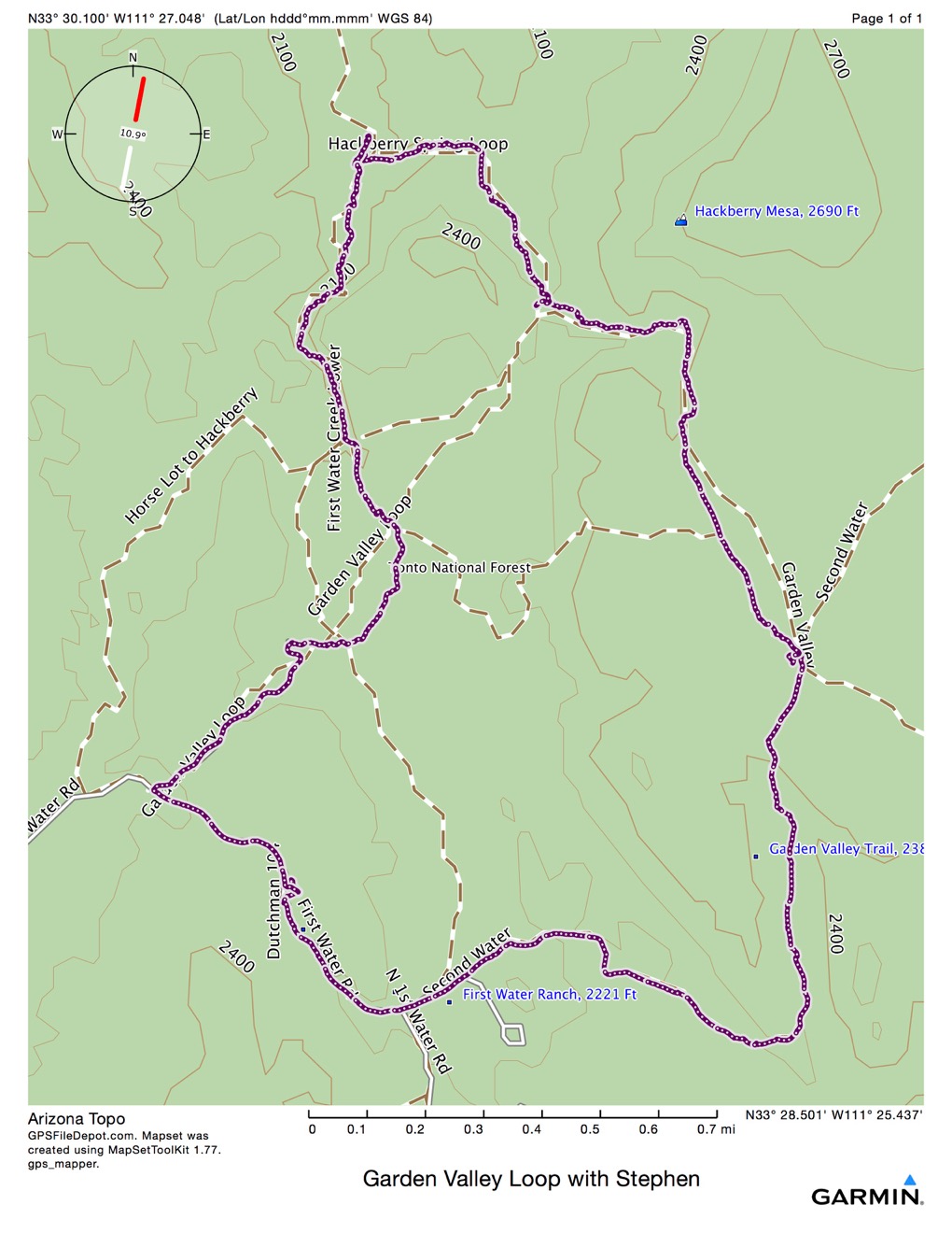
I got up at 3 to get everything ready, eat my breakfast smoothie and perform all the morning cleanse activities. I am ending the 3rd week of the “clean cleanse” and avoiding extreme exercise for two reasons. The cleanse program suggests only light exercise, and, my energy level, without coffee, has gone negative. While preparing, I read some of the Hiker’s Guide to the Superstition Wilderness and concocted a new and better plan! We’d hike the Garden Valley Loop instead, of about 5.4 miles, with lots of interesting sights along unmarked trails. This would limit our exposure to under 3 hours and be much more reasonable, aside from the fact that the trails we would hike would be unmarked. I had seen the beginning of the loop while hiking Second Water earlier this year, and although there are no signs for Garden Valley, the footpath was fairly clear.
I left about 4:30 and was at Stephen’s house by 5. He was waiting for me and came out the door. Stephen agreed to the new plan, and we signed in and headed out. We met 3 people hiking back toward the trailhead on our way out - they must have started even earlier than we! We hiked up Second Water to the point where Black Mesa heads east, and kept going. In another 50 feet, there is supposed to be a prehistoric indian ruin, a pile of pottery shards, that allegedly looks like a pile of rocks. Stephen and I searched for a while, but found nothing. Probably in the 20 years since the book was published, people have taken them all away as souvenirs.
In another 50 feet, the Garden Valley loop branches left to the northwest. The first mile or so of this trail took us through “Garden Valley,” a very flat stretch covered in loamy soil that looked good for cultivation. The ancient Salado people allegedly irrigated this land using canals, but there remain no sign of the canals. The walk climbs gently out of First Water Creek (dry almost always) and then turns west and descends again into the creek bed. I was hoping to find Hackberry Spring, and we searched, but came up dry, to make an obvious pun. The little spur toward north below was us looking for the spring.
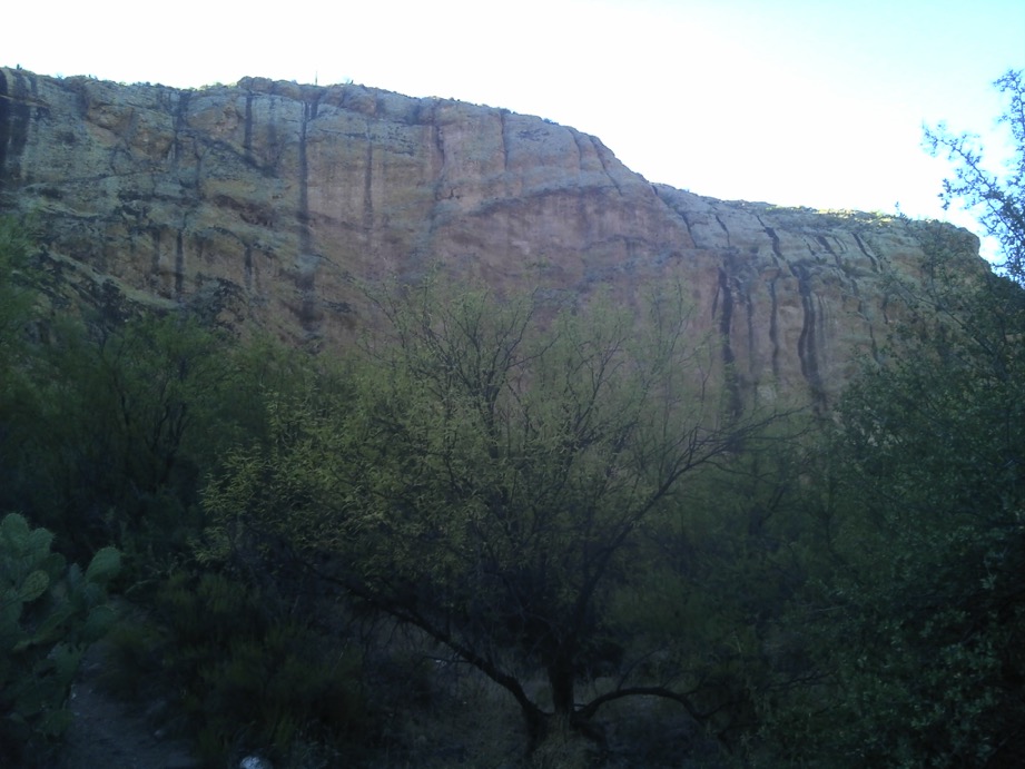
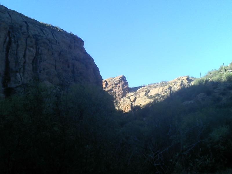
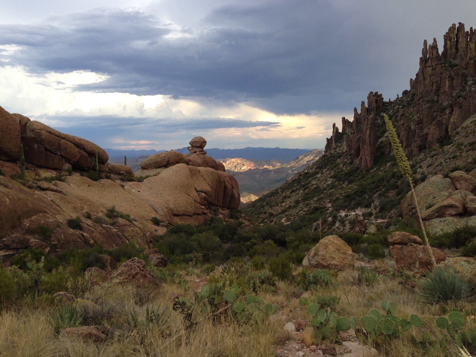
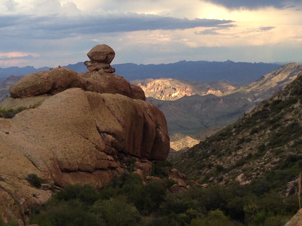
Turning south and following the creek bed, we could see the massive cliff ahead, and the map showed that we would walk right to the base of it.
Stephen pointed out a teetering boulder ahead and I snapped the photo below. By the way, these two photos were taken with my GPS, but I have a plan for later tonight to use my iPhone rather than with my Garmin GPS, in reaction to a young lady’s comment that I needed a better camera.
Hiking into the shade of the massive cliff, we both noticed that the temperature dropped rapidly. This was a cool place to spend a hot day! And just then, we heard people, and walked upon 4 youngish boys with hammocks slung, cooking a soup on a backpacking stove in the shade! We spoke with them a bit and the boy with the bridge hammock told us it was comfortable enough, but he’d been flipped out of it several times. Guess that salves my curiosity over this type of hammock.
Stephen and I hiked on, and made a few arbitrary choices at trail intersections. There are many return routes, and we just picked randomly. We saw a rather huge hawk-like bird with a white stripe across its tail, which I’ve never seen before. Stephen found a feather with white markings which we thought may have come from this bird, and we stuck it in his pack for one of his daughters.
Soon we crossed the fence marking the wilderness area boundary, and then walked upon the old windmill and structures from an old cattle operation. From there, we followed a track, which is Forest Service road FS78, back to the trailhead road, and then to the car. Stephen enjoyed the ice cold ginger beer I had brought for him, while I sipped my sparkling water and drove back to Stephen’s house.
Camille fixed us a super salad and we spent a good hour cooling off in the pool and chatting. Then it was time for Stephen to work on his nap, Camille to study, and me to drive home. I also had a brief, but deep, nap (I didn’t sleep long, but I slept hard) before it was 3 pm and time to head for the second game!
Game Two
I left home about 3 for the hour drive to the Peralta trailhead. All the way up the gravel road, I didn’t meet another car. What the heck? It was only 111 while I was driving through Mesa. But at the trailhead, a mere 106. And there was a single pickup in the lot. When I got there, the sky was black. I decided I’d better pack a rain jacket, cover for the pack, and my little hiking umbrella.
Before I could get going, a couple young guys pulled in to the otherwise empty lot and started asking me about trails. They were also going to Fremont Saddle, did I come here a lot, and did I want to hike with them? They play music. But it’s all classic rock, no rap. I said, well, gee, I happen to like rap, They asked was I being a wise ass (teasing) and I was. They obviously said no rap because to them I am an old white guy would probably wouldn’t like rap, and I called them on the stereotype. Anyway, they tried to keep with me, and I was only stumbling along, not trying to rush. I dropped them, and their mini boom box, like a bad habit. Which it was. I think they stopped to smoke. I saw them again from atop my perch when they finally reached the saddle, but only briefly.
It was HOT going up, even at a snail’s pace. I had allowed 2 hours to hike up what I remembered as 3.3 miles to the saddle. I didn’t stop, but I did slow after some of the steeper, longer climbs. The thunder was rumbling away, and large drops of rain began to fall. Or, maybe it was from me. Then the rain stopped as I kept hiking. At 2.3 miles I told myself, only another mile. I was feeling very weak, a little gauzy (like, not greying out, but, maybe almost) and wanted to reach the saddle without incident. Then at 2.4 miles, I realized I was at the saddle. My memory was 3.3, but it was only 2.4.
Here’s a view south on the way up. I thought the sun hitting the slope from the west, and the holes in the clouds, made a neat pattern that was ever changing:
Jaeda, this is an iPhone photo. I wonder if these look better? Or do I need a YABC (Yet Another Better Camera)?
I climbed around some of the larger rocks, and always saw one more rock a little higher. I wanted to be at the highest point I could get to with an ability to sit and face east. The sun was still in the sky in the west, but the black thunderstorms coming up from the south were starting to obscure it. I found my rock, marked with the summit waypoint ‘Fremont’ on the map below, and sat down. I found I had cell coverage, and check the weather - uh oh - severe thunderstorm warning, and the radar showed it heading right toward me. All of a sudden, the breeze became stiff and it began to pelt rain onto me. I got out my ultra light backpacking umbrella and put the rain cover on my pack. Problem was, the cover is for a full size pack, and I had only a small daypack with me. I tied it up, and the breeze forced me to put the umbrella away or lose it.
I could see the lightning and the storm were mostly on the other (west) side of the Superstition Ridge, but it looked like it was coming right at me. I saw a rainbow forming below me to the south:
iPhone Photo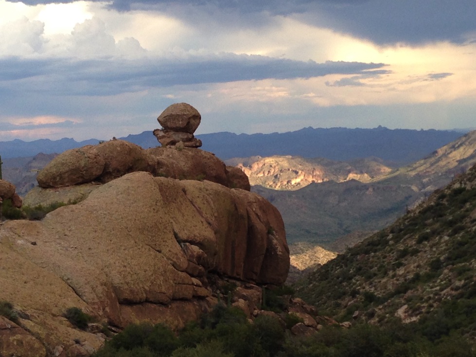
iPhone Photo. There is a nice rainbow forming just to the right to the natural rock cairn, in the Peralta Canyon.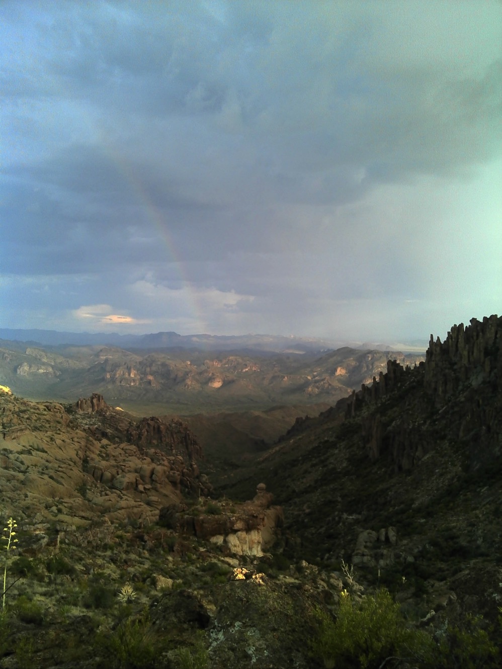
This GPS photo shows the rainbow much more clearly!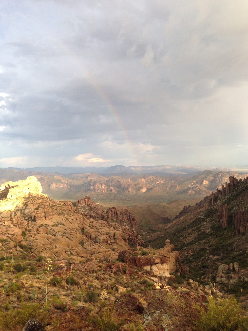
So does this iPhone photo
And this iPhone photo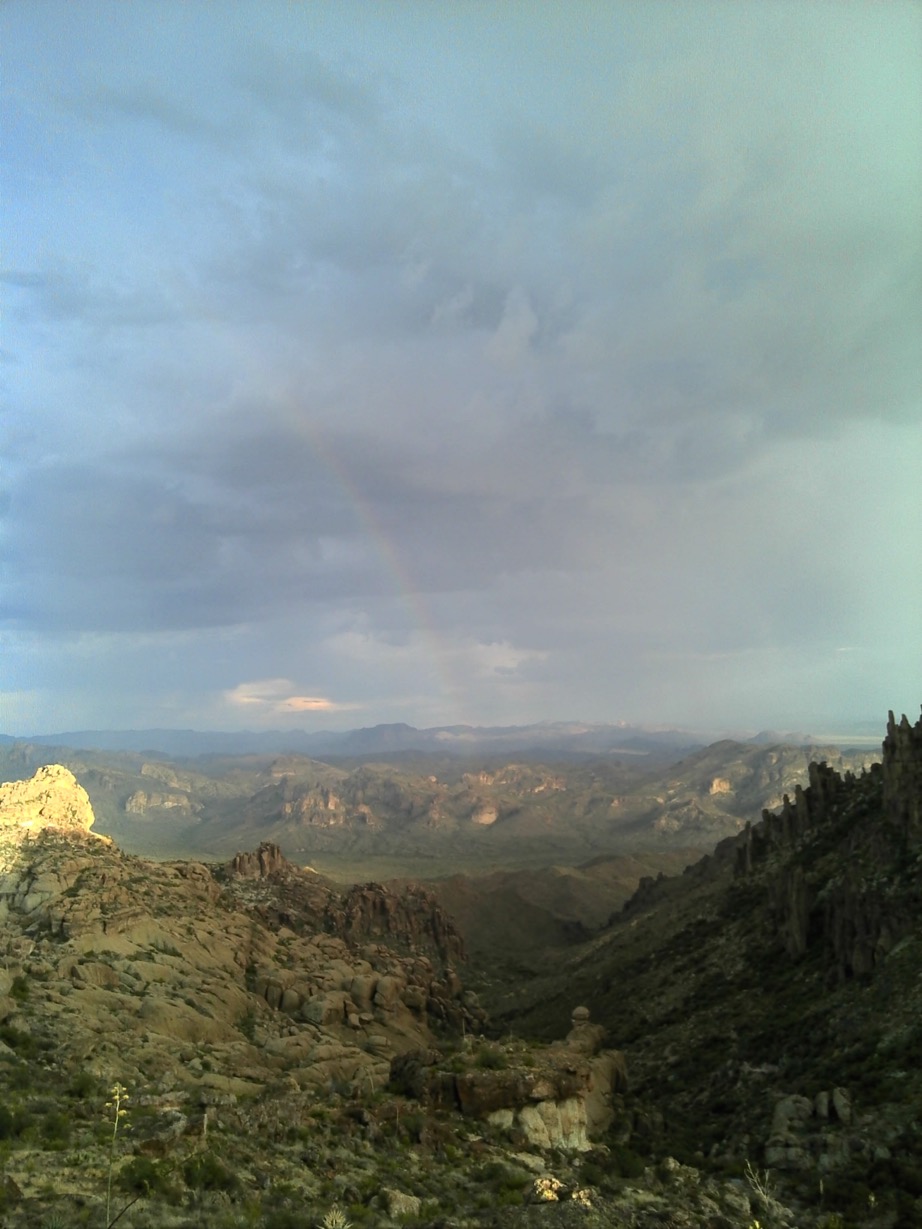
from the Garmin Montana 650 GPS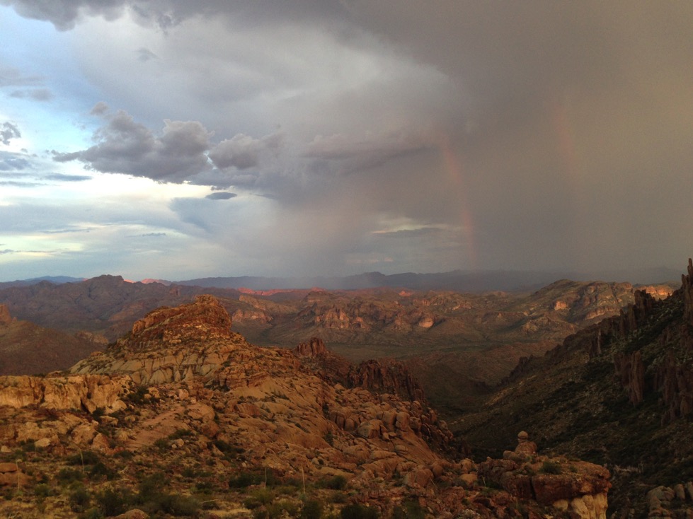
From the iPhone. The storm is blowing at me on the right (west) side of the photo. For a moment it looked like a second rainbow would form, but it didn’t.
As the rumbling got closer and the lightning strikes more frequent, I started thinking about what a reasonable person might suggest at this point. You might wonder how I could know, but, I do know one reasonable person, so I imagined what she might say. And therefore, it was time to find cover, not from the rain, but I didn’t want to be the lightning rod. I climbed down and walked around behind the big rocks, and lo and behold, there was just what I needed, where the map waypoint says “Lee” I found a nice, dry little cave in the lee side of a huge boulder. So I walked up in there, still 40 minutes until moonrise, to ride out the leading edge of the thunderstorms. Not only could I not get hit by lightning here, I was staying dry, or, well, getting dry, since I was drenched in sweat from hiking up.
The only problem with this cave is that I could only see to the west. The sun was still up there, shining through and lighting up the tops of the tallest thunderheads. It rained fairly hard, but I didn’t see any lightning strikes on my side (east) of the Ridge. After a while, the rain abated, and my intent to see the moon rise forced me out of the cave and back to my vantage point.
As I sat there facing east, the storm continuing to pound just across the Ridge, I realized that the cloud cover had the eastern horizon totally socked in. I figured I probably was not going to see a moonrise, and maybe not even a moon. But I decided to wait. Sunset was 6:56, and moonrise 6:55. Because of the mountain ridges, sunset might come earlier, and moonrise might come later, so I decided to wait until 7:15. I watched the horizon, the clock, and the amazing display of air to air and air to ground lightning being shown to the south south west. Hoping it stayed there.
Well, I stay until 7:15, and, no moonrise. When the sun finally settled over the Ridge, it began to get dark quickly. Of course I had my headlamp, so I donned it, and decided to climb down off the rock and at least find my way back to the trail, which would be difficult to do in total dark, even with a headlamp. So I walked back to the west, found the trail, and glumly, deflated by the failure of my grand plan to watch the full supermoon rise from a high place, started back toward the walk down through Peralta Canyon.
I hadn’t gone far, when the trail turns to the east around the ridge on which we visited Geronimo’s Cave, and I glanced up to see the full, bright, huge, supermoon just above the horizon. There must have been a break in the cloud cover just at that time. Glory!!!
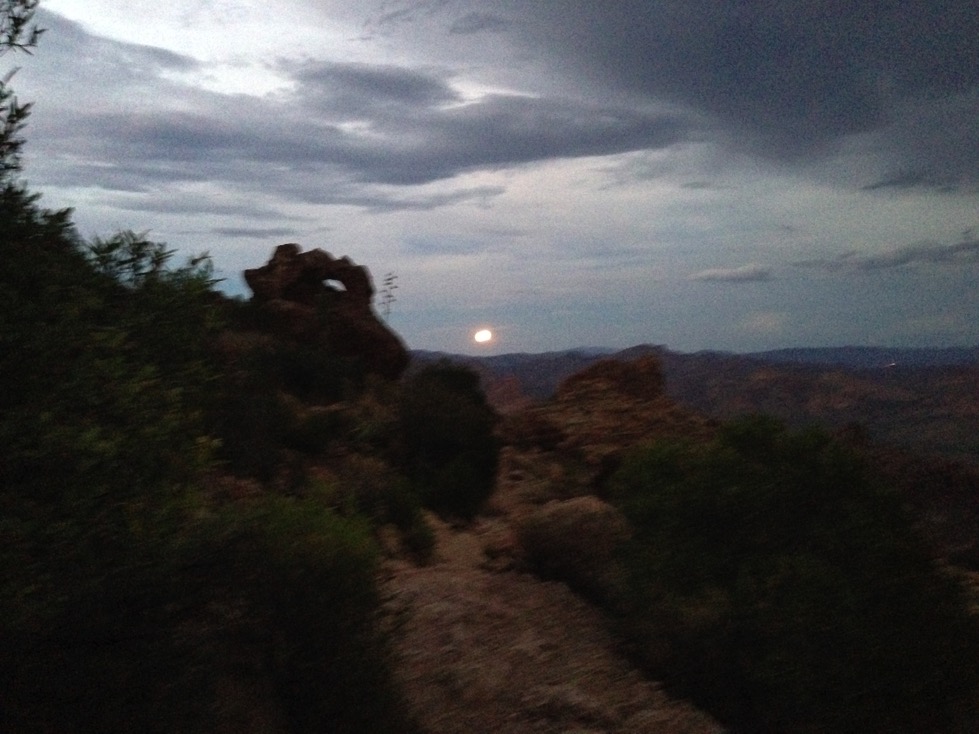
The rest of tonight’s photos are with the iPhone. I had the flash set to “auto” but it never went off. It was so dark, the shutter speed was so slow, that the photos looks very grainy. It was much more impressive in person. Check the eye of the needle rock formation just north of the moon - kind of cool!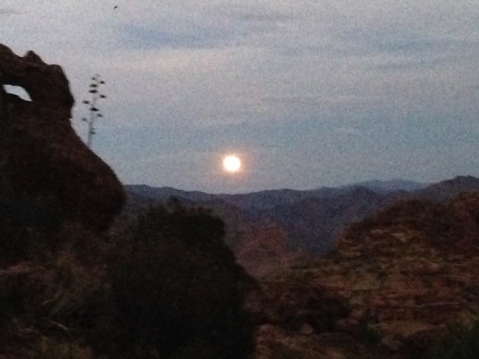
Zoomed in a bit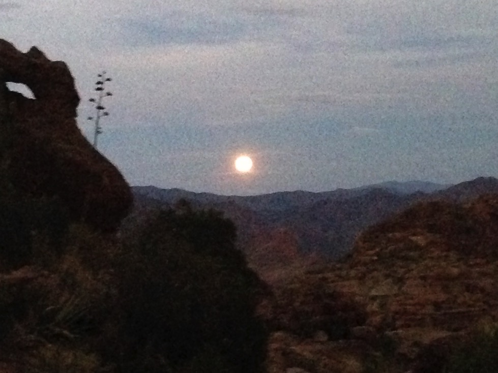
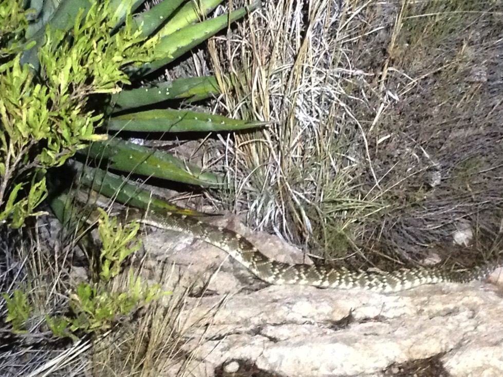
Well, I was exonerated! I had seen the supermoon rise from atop the saddle! Feeling pretty pleased, I started stumbling down the trail with my headlight on the low setting, to see if I could hike in just moonlight. In about 50 feet, I barely saw this in the middle of the trail ahead of me:
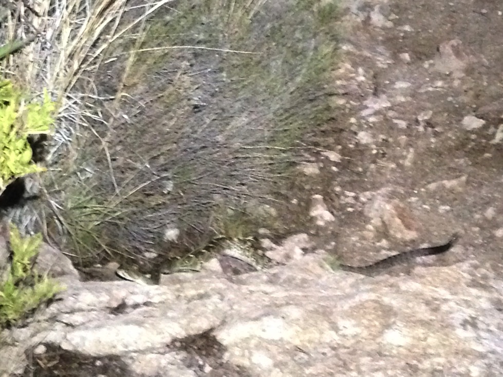
This is a terrible photo, but there are more coming.
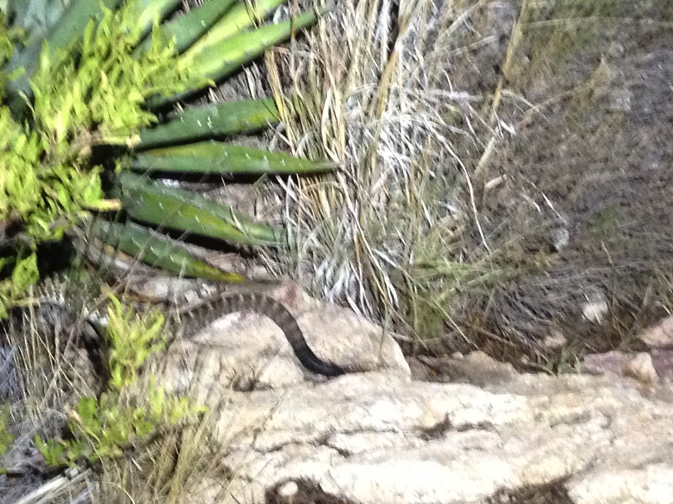
It was a diamondback rattler, about 6’ long, coiled in the middle of the trail. Probably trying to absorb the last of the day’s heat before going off elsewhere. I was about 2 steps from it when I spotted it and halted. There was no way around it, with a rock face jutting out from the left, and a drop off on the right. When I stopped, the snake which was already coiled, stiffened up, poised to strike, head up, tail up, but too far from me (I hoped) to get me. I clicked my headlamp up to high, and stared right at it without moving. After some seconds, it seemed to sense I wasn’t coming closer and it relented, and eventually started, ever so slowly, slithering off the trail to the left and into the underbrush. That’s when I thought to take out my iPhone and starting shooting. The first photo (above) was a little shaky, because I was holding the phone. And I was a little shaky.
Just think, if I were a NY moon gawker, that snake would have gotten me! Good thing I was watching down as I walked.
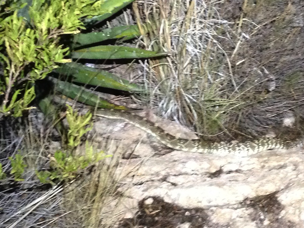
This video is from my iPhone and lit up by my headlamp. It’s a little shaky as I moved to see that the snake was heading off the trail, rather than towards me along the side of it.
Well, after the snake left the trail, I snuck by. Its rattler was still on the trail, and it was a little scary but I scooted by and didn’t get struck. Any notion I had of being sleepy vanished immediately and I kept my eyes wide open the rest of the way down. I also saw 3 tarantulas. They just kind of sit in the middle of the trail and don’t move. These tarantulas were pure black, which is not what I’ve seen in displays.
Anyway, I kept eyes on trail, even though the lightning show was getting better and better. Thunder boomed all around, but there were no close strikes, and it didn’t rain. I made it back to the car in about 80 minutes, still sweating, and with no stumbles. I spent a few minutes texting my location, etc. to my safety net and headed out. Somewhere along the road to AZ 60 I got cell service and an update on the huge storms battering Mesa.
After an hour drive home in some rain, I realized I was still having an adrenalin rush, which I am not used to. Adrenalin from being subject to lightning strike, from being afraid to miss the moonrise, from seeing the moonrise, from nearly stepping on a rattler, from the tarantulas, from hiking down in the pitch dark, and from the massive storm all around me. It took a while for the adrenalin to dissipate, even though I’d been up since 3 am.
Quite the hike! In retrospect, I was somewhat lucky. I was lucky that the snake moved off the trail, or I would still be standing there. I also managed things very well, keeping my head, thinking, and doing the right things to make a potentially dangerous adventure come out all right.
And besides, what NY moon gawker goes hiking in the desert in the middle of August. Twice. ???