This time I packed both the bughut (tent) and my hammock, in case I found a place to hang it. I had enough for a single overnight, and my pack weighed 27 pounds, with 3L of water in it.
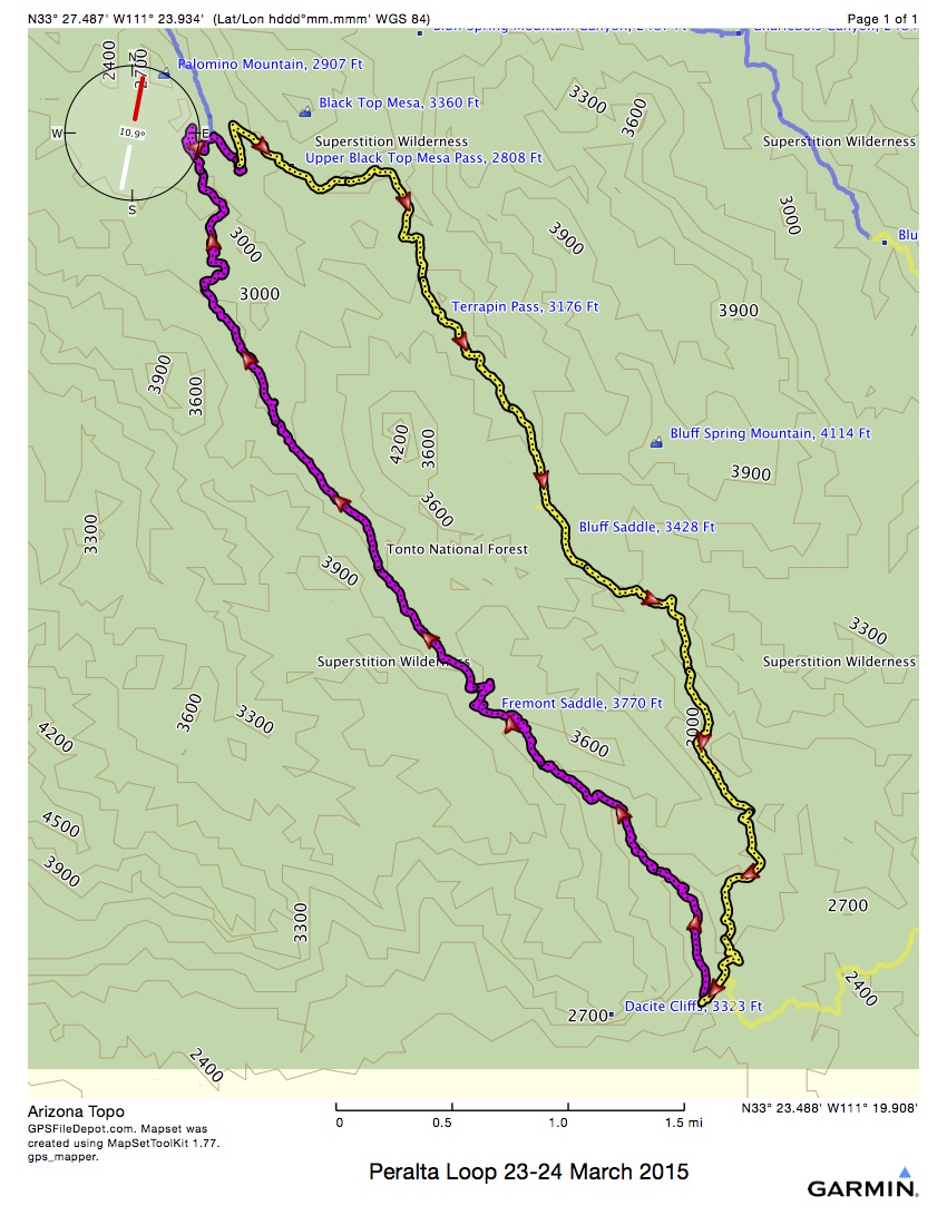
I headed out from the parking lot shortly after 7, and ended up hiking 7.6 miles in 5:24 elapsed time and 4:26 moving time. Two cars passed me on the 8 mile washboard (road) in to the trail head, and several more arrived while I was donning my boots, gaiters and pack. When I signed in at the register, everyone was heading out the Peralta Trail, same as me. Oh joy!
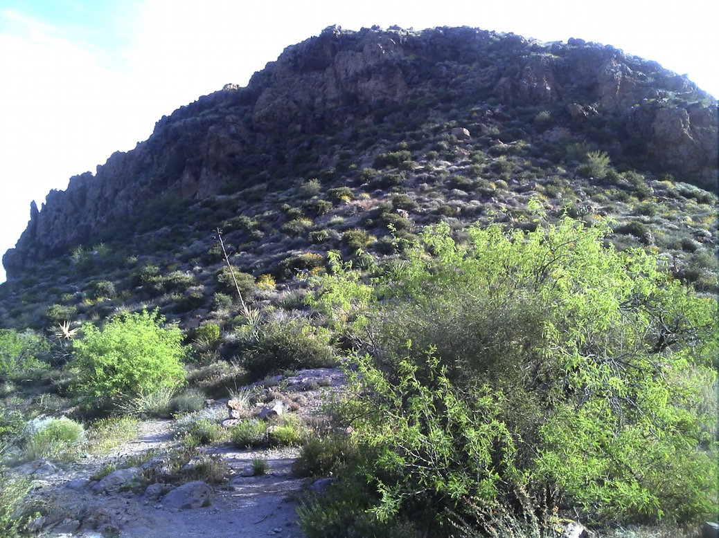
The first point of interest was Fremont Saddle, about 2.3 miles from the trail head and up quite a way. I followed a couple guys, and was passed by a young fellow, and then 2 couples before I got there. Just as I arrived, a trial runner came through from the east. So, there were 8 of us sharing the first scenic point in the “wilderness.” But, I climbed up on a rock away from the others, ate a little snack, and took these snapshots:
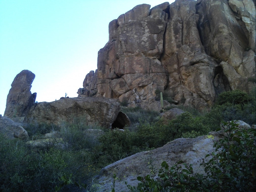
This is part way up to Fremont Saddle. There is a trail over to this, the Cave Trail, but I didn’t go there this time.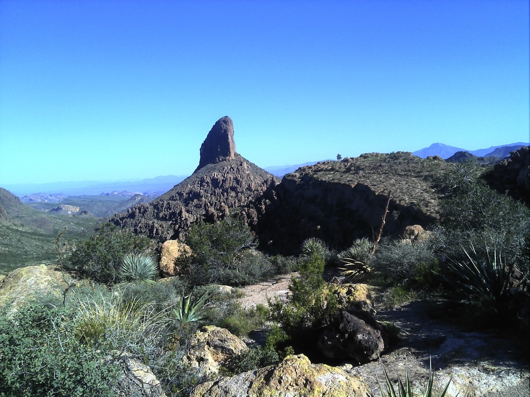
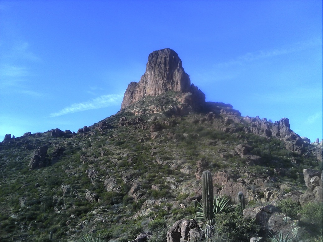
Sitting on a rock at Fremont Saddle, looking North at Weaver’s Needle.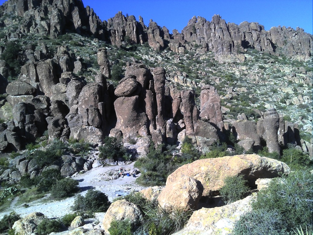
Sitting on the same rock, looking at the geology just to my west.
I sat here eating a snack, mesmerized by the stark beauty. How do these structures evolve?
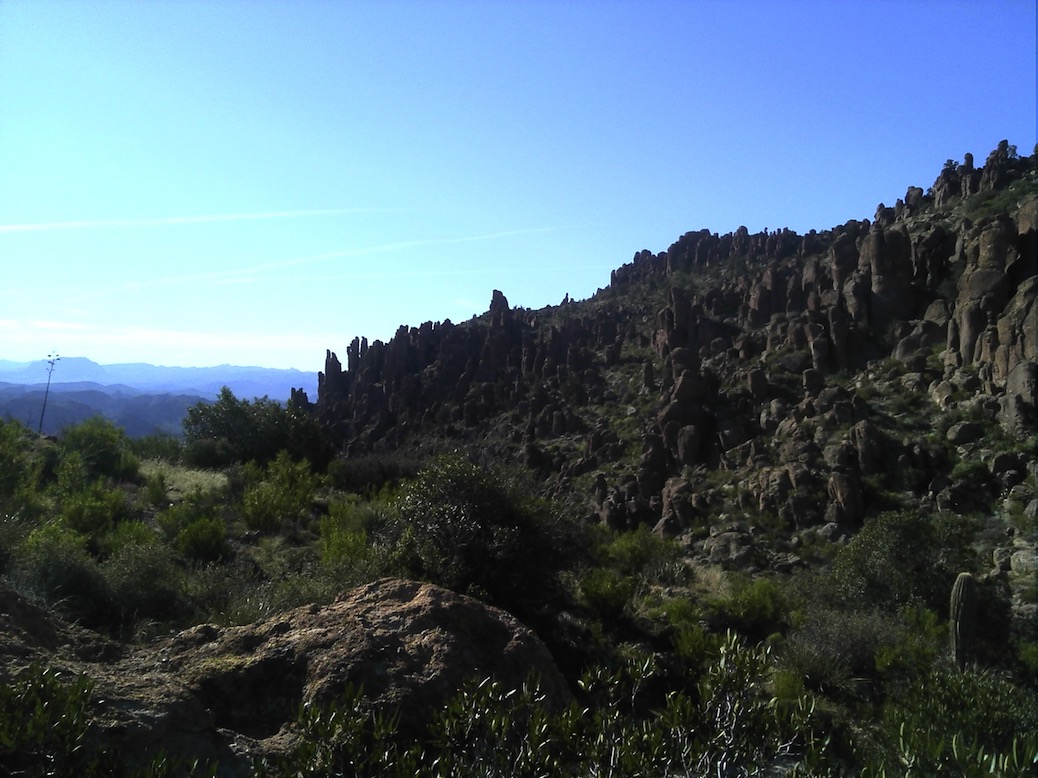
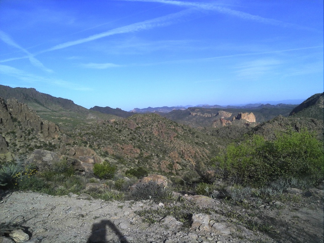
Looking to the North
I took my time walking north on the Peralta Trail. I didn’t really have a fixed plan. I noticed my feet getting tender again - this time, I was wearing Injinji socks, and the calluses on my big toes were getting sore. I was kind of determined to not beat myself up so much this time.
All the other people that were at Fremont Saddle must have gone a different way, because I saw no one, until I started down some mild switchbacks nearly at the end of Peralta, where it tees into Dutchman’s. There I saw 3 horse riders coming up the trail. When they got close, I stepped off the trail on the downhill side, and we chatted for a while. They were wondering if there were a trail that loop back to the west to take them back to First Water where they had begun. I told them no, not unless they went south all the way to the Peralta Trailhead. They didn’t want that option so they turned around and passed me again, on the way down.
Once at Dutchman’s I decided I had 3 options: turn around and hike Peralta back to the car, hike back to the car the way I did two weeks ago, but this time in daylight, or find water and a place to spend the night. I was just about to head up Dutchman’s for the car, and I met the leader of the horse troop on foot. I told him I couldn’t find water, and he said there was water right there. And, there was. So, I walked up the trial about .2 miles to explore the campsite there. I looked and looked, and finally found a spot to hang my hammock. On the first try, the branch broke off when I tested it, and I wound up on my butt. But I tried again, and a sub-optimal but sufficient hang:
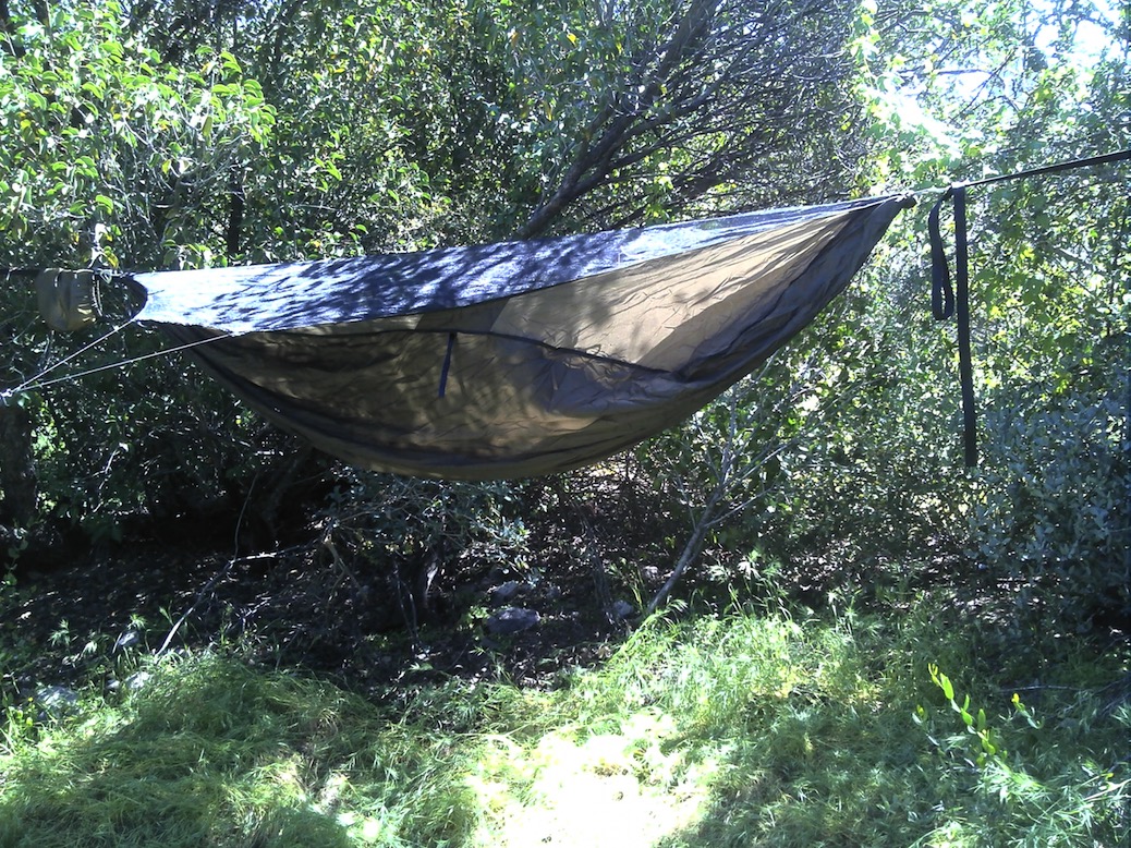
These “trees” weren’t quite tall enough to get a great hang, but, when I got in it, my butt was a few inches off the ground, so it was good enough!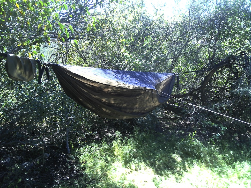
Off with the boots, on with the crocs, and then I took my filter back about .2 miles to the water. I pumped a gallon, drank a quart and pumped another quart into the Nalgene canteen. Then I put my feet in the creek almost up to my knees. Felt great!
Back at camp I ate my lunch on a rock by the trail. Spoke with a couple day-hiking the loop I will complete tomorrow as a day hike. I could have done that, but since I brought my 27 pound backpack I may as well spend the night. Nothing to rush back to my apartment for.
I got in the hammock and put my map over the ridge line to shield the sun and I napped for a couple of hours. Drank some water and read my book on the rock for a while. It was about 3:30.
About 5 I made some coffee and then my Katmandu curry supper. Everything is set up to cook a cup of coffee in the morning. I put my remaining trail food in a zip lock up in the branches above me. My pack is on the ground next to me. There are some burrows under the tree at my feet and I don't know what made them - or if they are currently inhabited. I guess I'll find out tonight maybe.
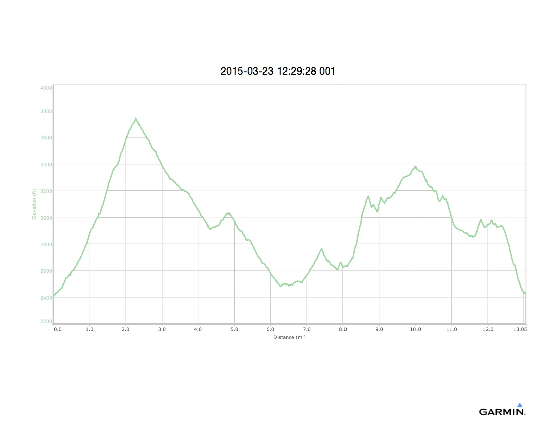
For the day, the trip computer says 7.62 miles, 4:26 moving time, elevation 2512, 1578' total ascent
Lying in my hammock a sliver of moon is right in front of me - in the west. It must be setting, following the sun down.
The night was very cold and I shivered most of it. I hadn’t brought enough warmth layers. I didn’t get molested by any critters during the night, nor did my food or my gear. After sundown there was an enormous chorus of bird squawking and fluttering. I suspect I had invaded the trees they nest in. But they eventually settled down. I watched stars for a long time, and saw 2 shooting stars, And again, lots of jets.
About 5:30 I was so cold I had to get up. The sky was beginning to lighten in the east, so I lit my stove and boiled the water for my coffee. As it cooled, I packed things up and got dressed for the day. By the time I was packed, the coffee was ready to drink, and I headed south on the trail a little before 6:30.
Weaver’s Needle really dominates. I had hiked north around it on its west side yesterday, now I was hiking back south on its east side today. These photos were all taken while I was standing in Terrapin Pass. This one (above) looking south.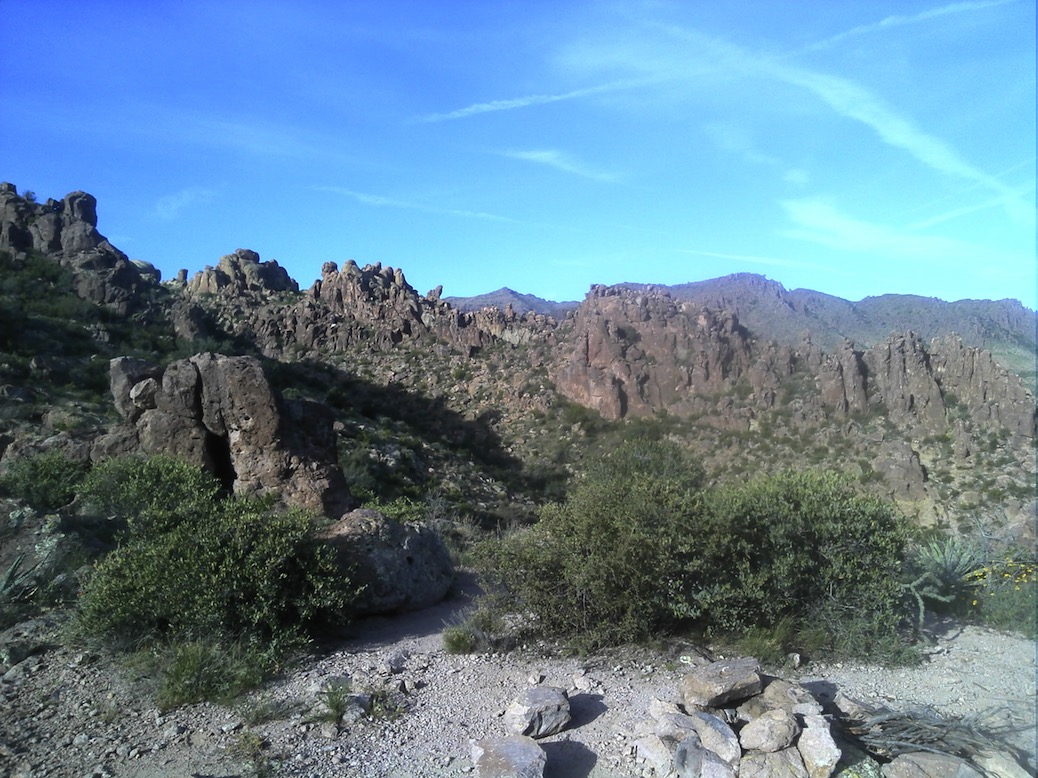
Looking west (see my shadow?)
When I got onto Bluff Springs Trail, I met a group of 9 older people, hiking up. Then a group of 6 young people. Then a single girl. Then a couple. Lots of company on the trail today. Back at my car by about 11:30, 6.7 miles, 4:49 elapsed time, 1555’ ascent, 1640’ descent. Sore feet, but no damage.