On the drive east to the trailhead, through the desert valley, a wide cloud spread itself east toward the coming sunrise. It looked like a highway paved in the sky, pink, purple, orange, for the riders in the sky. As the sun rose below the horizon the colors continued to change, the cloud vapor bending the colors as it began to fade away in the rising heat of the coming day.
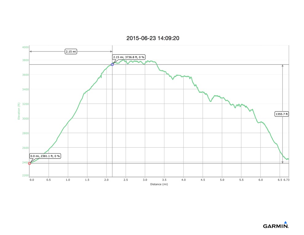
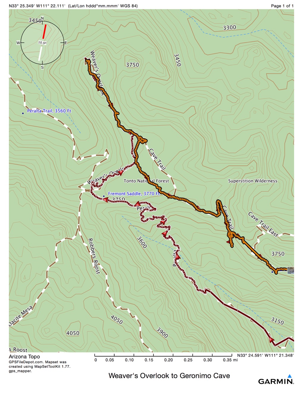
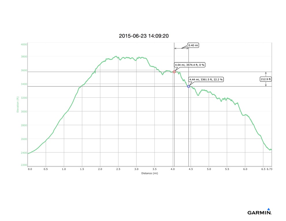
We started hiking at 7:25 and hiked a total of 7.5 hours. We stopped many times to admire the views, rest, cool off in the shade and the breeze, and also spent a bit of time route-finding on the way down. So the moving time was only 3:55, making the average moving pace just under 2 mph - a fairly standard hiking pace. We covered 7.7 miles, and 2100’ of ascent (and descent.) It was about 84 when we started, but well into the 100s when we finished.
This ended up being a very strenuous hike on a very hot day. The initial plan was to rest at Fremont Saddle, then come back down. But I also knew of another trail down mostly parallel to the Peralta Trail, and a destination on the way called Geronimo Cave. When we got to the top, we discussed the options and changed plans. We ran out of water about 30 minutes before reaching my car, which is just about perfect.
We started hiking up the Peralta Trail from the trailhead, intending to reach Fremont Saddle. I had hiked through here a couple of months ago on an overnight trip. We had both hiked part way here a few weeks ago with another friend and a couple of children. We turned back when the kids got tired; this was our chance to reach the Saddle and have a nice view.
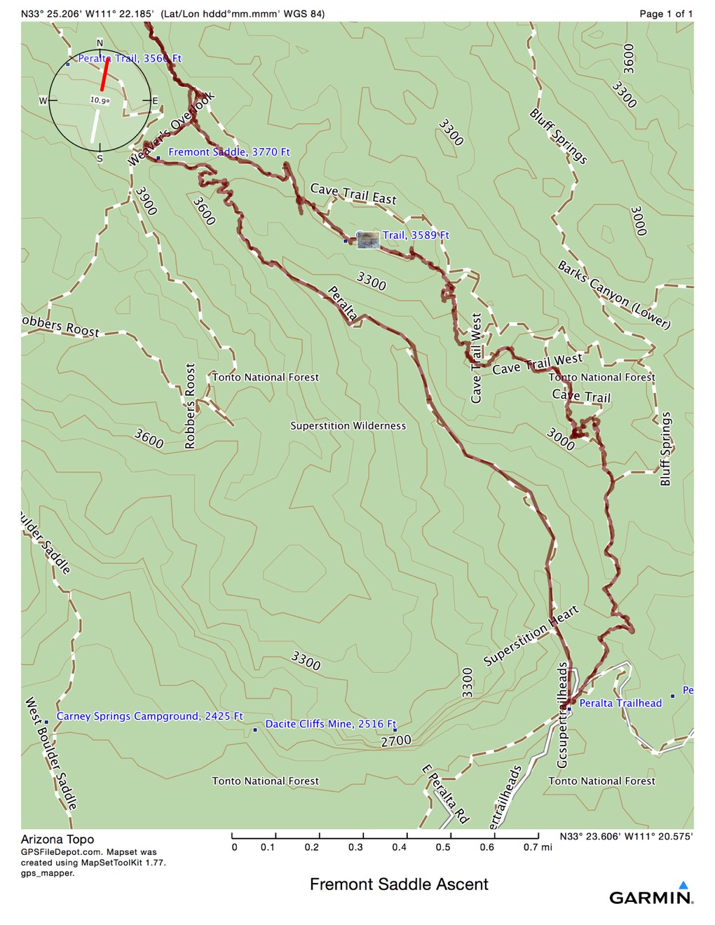
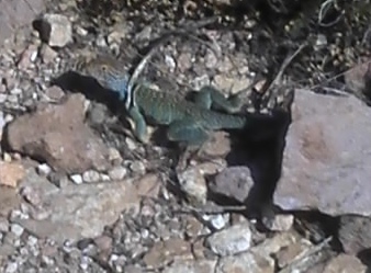
Reaching the Saddle at 2.15 miles, and about 1400’ ascent, it was about 8:50 - so it took 1:35 to reach the Saddle. I stopped to photograph this little guy on the way:
The next trail half mile, and about 36 minutes, took us about as close as you can hike to Weaver’s Needle, on a trail called Weaver’s Overlook, to the NW end of that trail and a place that could only be called Weaver’s Overlook.
The view? Oh, yeah: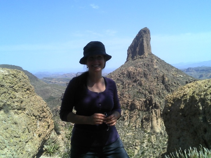
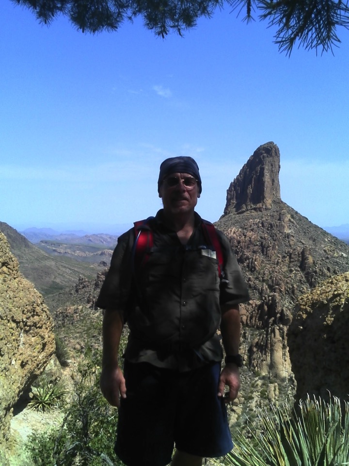
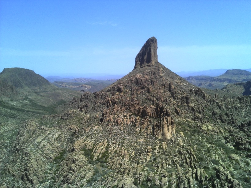
Looking mostly north
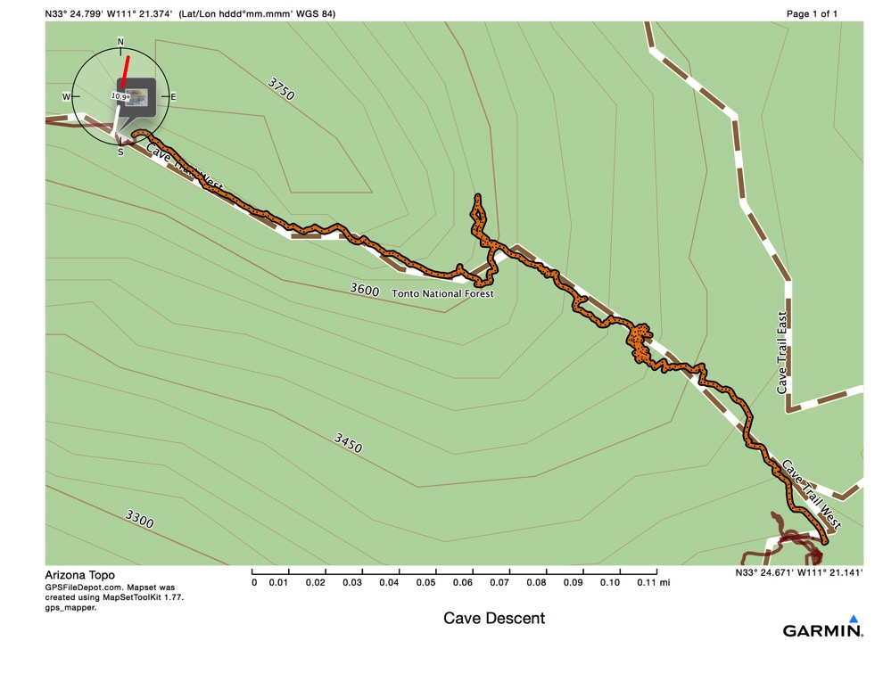
After looking, enjoying a cool breeze, and cleaning up some trash at a geo-cache, we turned to head back, then continue east then southeast on the Cave Trail. There are no markers on any of these trails. The major, maintained trails have a single signpost where they intersect. Other than that, you follow a path, footprints, cairns where available. or your GPS. On the rocks and scrambles this trail had many places where footprints and path were absent. If there weren’t cairns, and most of the way had none, we relied on Garmin for finding our way. This led to many false leads, only to reach a dead end at a box or a cliff too steep to descend safely. As it was getting a lot hotter very quickly, this could have led to thoughtless action. We remained calm, rested often whenever we chanced upon a small spot of shade, rationed our water, and performed like seasoned adventurers. Intrepid? Well, maybe.
This 1.3 miles took us just under an hour to trek. My hat is off to Camille for suggesting that we rest often and find shady spots to sit in the breeze. She was concerned about marshaling her remaining energy and not becoming the dehydrated, hyperthermic rescuee that we often read about in the paper out here. I was concerned about not becoming the “experienced” guide who took a good friend out into the desert, map, compass, GPS and all, and became less than found. It was now pretty hot, and we had been hiking in the desert for a lot longer than I would have planned. This return route wasn’t much longer than the route up to Fremont Saddle, and should have been easier and quicker descending, except that we had to “throw around” many, many times to find the correct route. It wasn’t that we were hiking slowly or weakly; it was that we couldn’t discern which way to hike. It was about 11:30 am when we got to the shade of the cave.
It was at about this point that Camille asked me if I had told my Dad where I planned to hike - I hadn’t. She hadn’t told anyone either. Realizing this to be a grievous error, I decided all we could do at this stage was to be very cautious and get back safely. Of course, having changed plans at the Saddle, had I told anyone my intended route, I was already off it, but at least they would have been able to find my car in the parking lot. I had better learn this lesson. I often just get up and go, and think only in terms of what I am doing in the moment. Even though I take all the precautions I can to prevent an accident, I rarely think ahead to take precautions that would serve in the case of an accident occurring.
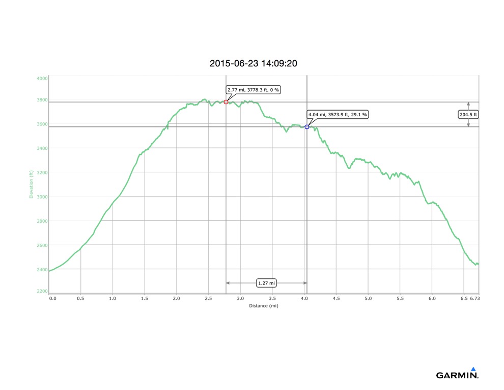
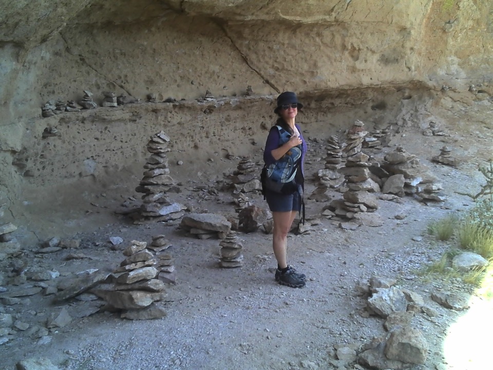
Once at Geronimo’s Cave, in the shade, I felt relieved to know that we were on the right trail (Garmin was pretty sure) and concerned about the rising temperature and shrinking water supply in our packs. We had been away from the car for over 4 hours now, already more than the original plan, and had hiked about 4 miles. Therefore, we didn’t linger here, where so many before us had; we pressed on. Not exhausted or beat, but, rightfully concerned about the time, temperature and distance yet between us and the air conditioning and water awaiting us in the car.
The next 0.4 miles took us almost 40 minutes, and was very difficult. I am still not convinced that we followed the trail in our descent of this 212 feet. Each time I tried to follow the GPS track I found an impassable cliff. We tried several times to follow what looked like a footpath, and either got boxed in or wound up at a precipice. Finally, I found a passage through some boulders and we were able to scramble down a bare bedrock section. Camille led the way here, and I am pretty sure I would not have tried it if I had been by myself. Once down to the first level spot, we had to choose between a really steep rock, or a really steep crevice with small creosote trees and other bushes. We chose the crevice, and I took the lead.
Near the top of the descent, I walked right into an Agave americana, common names centuryplant,[4] maguey, or American aloe. I really didn’t stumble into it - I was looking ahead and walked into it. You’ve seen them - they look like this:
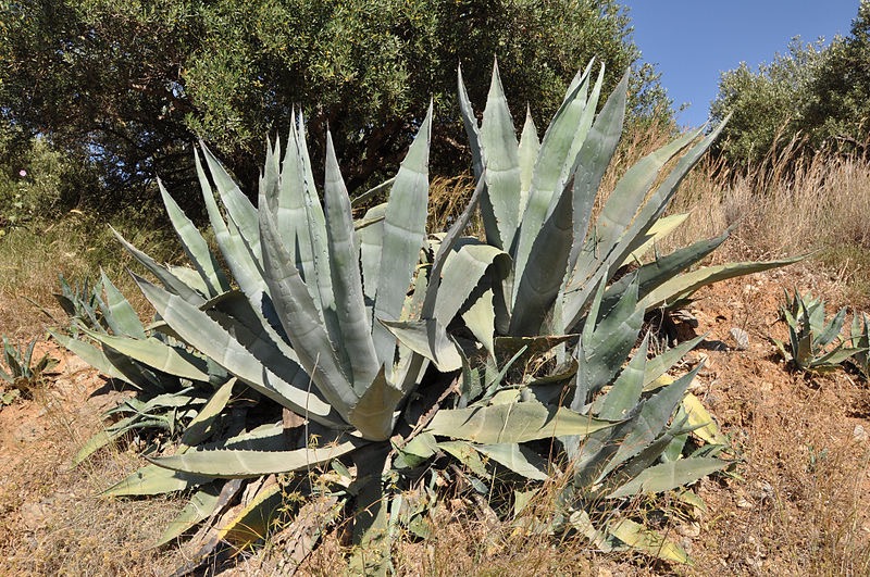
And here is how Wikipedia describes them: “Although it is called the century plant, it typically lives only 10 to 30 years. It has a spread of about 6–10 ft (1.8–3.0 m) with gray-green leaves of 3–5 ft (0.9–1.5 m) long, each with a prickly margin and a heavy spike at the tip that can pierce to the bone.” And the spike did. Well, it missed my tibia and sank deeply into my tibialis anterior, the shin muscle along the side of the tibia. The muscle where you get shin splints. Camille said it went in an inch. I remember watching the tip extract as I moved my leg back, and seeing the tip come out in whole, the last half inch covered in blood. I could tell it punctured my muscle, but it didn’t hurt that much until we were halfway home in the car, many hours later. Must be what it feels like to have a muscle biopsy without novocaine. It bled a bit, which I hoped would cleanse the wound. There seems to be no infection 2 days later. A few hours before this happened, Camille was showing me on an older plant how indigenous people used the heavy spike tip as a needle and the strands of fiber inside the leaves to sew with. And then I provided an in situ demonstration.
How can you watch where you are going when you are watching where you are going?
Once down that section, we rested again in some shade. Here is what our descent looked like from below:
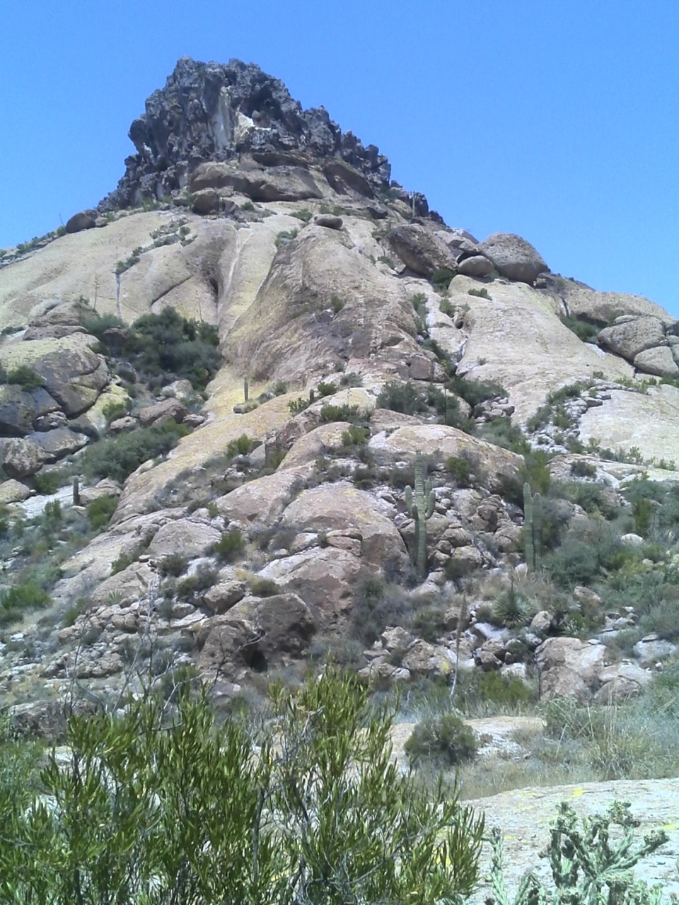
Hard to capture the scale and steepness in 2 dimensions, we came from behind the big outcrop at the top, straight down the right side of it, and down through the crevice with the brush in the right center of this photo. Then around to the right and down to where I took the photo from. It doesn’t look that adventurous on this web page, but let me just assure you, that it was amazing!!! The rocks were so hot now that we had donned the biking gloves I carried in my pack - to protect our hands from scratches and the heat of the rock face, supinely scrambling southward sur such a steep, smooth surface 😉 on our backsides, holding on for dear life.
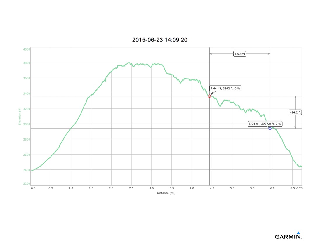
The next 1.5 miles, 424’ down to the intersection with the Bluff Springs Trail took us about 1:40. We had many false leads, again following nothing but GPS in many places. We found a cairn that led us down a steep pitch to an impassable dropoff - and we disassembled that cairn on our way back up to the trail. Part of the difficulty here was that on the Arizona topographic basemap in the GPS, there are two routes - East Cave and West Cave - from the cave to the Bluff Springs Trail. Part of the difficulty here was also that neither of these trails is still intended to be used. When we did get to the Bluff Springs intersection, a line of rocks had been placed along the intersection, a sign that hikers were not supposed to use the Cave Trail. This doesn’t prevent people from using them, or from going to Geronimo’s Cave, but it is apparently discouraged.
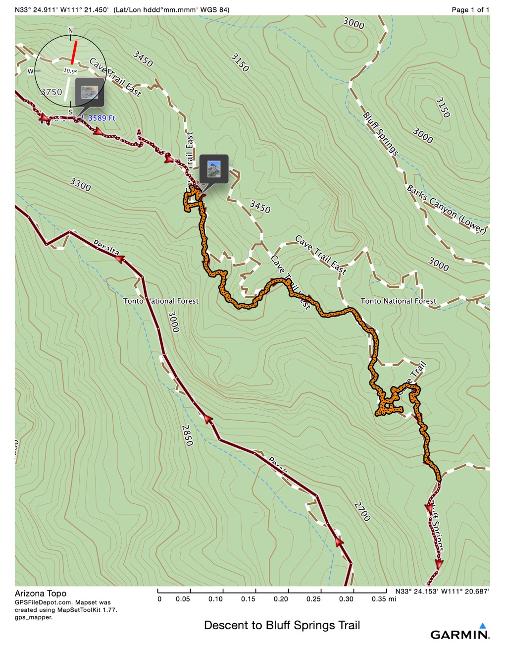
Once we turned onto the Bluff Springs Trail, we were home free. I had hiked this trail before, albeit in the dark. It descends steeply, almost 600’ in less than a mile. There are water bars and stairs most of the way down. We were very hot, but we also knew that we were close to being done.
Back at the parking lot, Camille was too tired to raise the register lid to sign us out. I had a couple bottles of water in the car - and even though they were in insulated packs, they were extremely hot, and not very thirst quenching. We stopped for cold drinks on the way to Camille’s house. That’s when I realized how much my leg hurt. After dropping Camille off, I stopped again for more cold liquids as I was very dehydrated and depleted.
We both wound up A-OK once we’d had a chance to recover. It was a very challenging experience, and we agreed, very enjoyable. We had a challenging hike down, but both thought it was interesting and almost fun to be challenged that way. As long as the conclusion was successful!